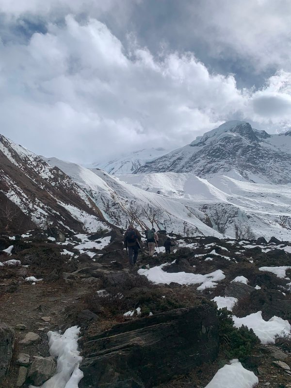
Mount Manaslu Trek
Mount Manaslu, the eighth highest peak in the world, offers a pristine and less‑crowded alternative to Everest. The classic route passes through remote villages, alpine meadows, and breathtaking glaciers. Ideal for trekkers seeking adventure and cultural immersion.
- Best season: October‑November and March‑April
- Duration: 12‑14 days
- Permits: Manaslu Conservation Area Permit + Trekker’s Information Management System (TIMS)
Preparation tips: Acclimatize properly, bring layered clothing, and hire a certified guide.
Why Choose Manaslu?
The Manaslu region remains one of the most untouched trekking areas in the Himalayas. With fewer tourists than the Annapurna or Everest circuits, you’ll experience authentic village life, vibrant Tibetan‑influenced culture, and dramatic mountain scenery that changes daily.
Highlights
- Cross the breathtaking Larkya La Pass (5,160 m) – one of the highest trekking passes in the world.
- Explore the remote community of Samagaon, home to the legendary Larkya La Sherpa guides.
- Witness sunrise over the snow‑capped Manaslu peak from the tranquil Yhsum Lake.
- Visit the stunning Budhi Gandaki river gorge and the historic Buddhist monastery at Samagaon.
Detailed Itinerary (12‑14 days)
Day 1 – Kathmandu → Soti Khola
Drive from Kathmandu to the trailhead (≈8 hrs). Overnight in a basic teahouse.
Day 2 – Soti Khola → Machha Khola
Gentle descent along the Budhi Gandaki river, passing waterfalls and rice terraces.
Day 3 – Machha Khola → Jagat
Climb steadily through forests and terraced fields, reaching the bustling market town of Jagat.
Day 4 – Jagat → Deng
Cross the suspension bridge over the Budhi Gandaki, then trek through bamboo forest to Deng.
Day 5 – Deng → Namrung
Steep ascent to Namrung, where you’ll get stunning views of the Manaslu range.
Day 6 – Namrung → Samagaon
Cross a high river and continue up to Samagaon, the base for the Larkya La Pass.
Day 7 – Acclimatization at Samagaon
Rest day: explore the village, visit the local monastery, and prepare gear for the pass.
Day 8 – Samagaon → Larkya La Pass → Bhrikuti
Early start for the challenging Larkya La crossing (5,160 m). Descend to Bhrikuti for the night.
Day 9 – Bhrikuti → Dharapani
Descending through alpine meadows, you’ll pass a stunning glacial lake.
Day 10 – Dharapani → Tilije
Walk through rhododendron forests and remote hamlets.
Day 11 – Tilije → Soti Khola
Long descent back to the trailhead, enjoying views of the sprawling valley.
Day 12 – Soti Khola → Kathmandu
Drive back to Kathmandu for celebration dinner.
Optional extra days can be added for side‑treks to the Tibetan‑influenced villages of Tarke and Chumchet.
Essential Gear
- Insulated down jacket (rated to –20 °C)
- Sturdy waterproof trekking boots
- Sleeping bag (comfort down to –15 °C)
- Warm gloves, hat, and balaclava
- High‑altitude trekking poles
- Portable water‑purification system
Cultural Insights
The Manaslu region is home to the Gurung and Tibetan‑origin peoples. Their monasteries, prayer flags, and traditional wooden houses provide a vivid glimpse into Himalayan life. Respect local customs: dress modestly, ask permission before photographing people, and avoid stepping on prayer mats.
Conservation & Responsible Trekking
The Manaslu Conservation Area protects fragile ecosystems and cultural heritage. Follow Leave‑No‑Trace principles: carry out all waste, use designated camp sites, and support local guide economies.
FAQs
- Do I need a guide? While the trail is marked, a licensed guide is required for the Larkya La Pass and improves safety.
- What is the difficulty level? Moderate to challenging – high altitude and steep ascents demand good fitness and acclimatization.
- When is the best time to go? October‑November (post‑monsoon) and March‑April (pre‑monsoon) offer clear skies and stable weather.
Embark on the Manaslu Trek for an unforgettable adventure that blends raw mountain beauty with deep cultural immersion.
Wildlife & Landscape
Manaslu region hosts rare fauna such as snow leopards, Himalayan tahr, and musk deer. Trekking through alpine meadows provides opportunities to spot these elusive species, especially in early mornings.
Accommodations
Teahouses along the trail range from basic wooden lodges to comfortable stone cabins with hot water and Wi‑Fi. For a more luxurious experience, consider staying in boutique lodges in Samagaon offering private rooms and local cuisine.
Local Cuisine
Sample traditional Nepali dishes like dal bhat, yak cheese, and steaming momos. Many villages serve tea infused with local herbs such as butter tea and juniper leaf tea, perfect after a day of trekking.
Manaslu Circuit Trek Overview
The Manaslu Circuit Trek is a 14 to 16 day journey around Mount Manaslu (8,163 m), the eighth highest peak in the world. Located in the Gorkha district of central Nepal, the route forms a loop that begins in the subtropical lowlands around Soti Khola, follows the Budhi Gandaki river through dense forests and remote Tibetan influenced villages, crosses the high Larkya La pass at 5,160 m, and descends through the Dudh Koshi valley to end near Dharapani on the Annapurna Circuit trail. The total trekking distance is approximately 177 km. Most trekkers complete the route in about 14 days including rest days, though side trips to Birendra Tal or the Manaslu Base Camp can extend it to 16 or more.
The trek is rated moderate to challenging. Daily walking time ranges from 5 to 8 hours, with some days on the pass crossing involving up to 10 hours. The trail includes long sustained ascents, narrow suspension bridges, and sections of loose rock above 4,000 m. Trekkers should have prior multi day trekking experience and a good level of cardiovascular fitness. Because the route passes through a restricted area near the Tibetan border, independent trekking is not permitted; you must be accompanied by a licensed guide and travel in a group of at least two people.
Despite its demands, the Manaslu Circuit rewards trekkers with some of the most diverse landscapes in Nepal. In the lower valley you pass through terraced rice fields and subtropical forest. Higher up the terrain turns to alpine meadow and glacial moraine. The cultural landscape is equally varied, transitioning from Hindu Gurung villages to Tibetan Buddhist communities with ancient monasteries, prayer wheels, and mani walls.
Day by Day Itinerary
While the classic itinerary covers 12 to 14 trekking days, a realistic 16 day schedule with acclimatization is recommended. Below is a detailed breakdown including the key stops of Samdo, Dharmasala, the Larkya La pass, and Bimthang.
Day 1: Kathmandu to Soti Khola (730 m). A long jeep drive of approximately 7 to 8 hours on rough roads via Gorkha Bazaar and Arughat. The road winds through hills and terraced farmland to the trailhead at Soti Khola.
Days 2 to 3: Soti Khola to Machha Khola to Jagat (1,340 m). The trail follows the Budhi Gandaki river through forests, waterfalls, and small Gurung settlements. Jagat is a checkpoint where permits are inspected.
Days 4 to 6: Jagat to Deng to Namrung to Samagaon (3,520 m). The valley narrows and the culture shifts to Tibetan Buddhism. Namrung offers the first clear views of Manaslu. Samagaon is the last permanent village before the pass and serves as the primary acclimatization stop.
Day 7: Acclimatization at Samagaon. A rest day with an optional hike to Manaslu Base Camp (4,400 m) or Birendra Tal, a glacial lake just above the village. This day is critical for adjusting to the altitude.
Day 8: Samagaon to Samdo (3,875 m). A short 3 to 4 hour walk up the valley. Samdo is a small Tibetan refugee village with stone houses and views of the Larkya La route. Another acclimatization half day is often taken here.
Day 9: Samdo to Dharmasala (4,460 m). A short but high climb to the last camp before the pass. Dharmasala, also called Larkya Phedi, has only a basic stone shelter. Trekkers go to bed early because the pass crossing starts before dawn.
Day 10: Dharmasala to Larkya La Pass (5,160 m) to Bimthang (3,720 m). The hardest and most rewarding day. The climb to the pass takes 3 to 4 hours over snow and loose moraine. At the top, prayer flags mark the summit with panoramic views of Manaslu, Cheo Himal, and Himlung Himal. The descent is long and steep, dropping 1,440 m to Bimthang, a scenic meadow camp beneath the peak.
Days 11 to 13: Bimthang to Tilije to Dharapani (1,860 m). The trail descends through rhododendron and pine forest, crosses the Dudh Khola, and rejoins the Annapurna Circuit road at Dharapani. A jeep drive returns to Kathmandu via Besi Sahar, or you can continue trekking onward to Annapurna.
Permits and Costs
The Manaslu Circuit passes through a restricted area, and special permits are mandatory. Unlike the Annapurna or Everest regions where independent trekking is allowed, Manaslu requires three documents and a licensed guide.
Manaslu Restricted Area Permit (RAP). Issued by the Department of Immigration in Kathmandu. The fee is USD 100 per person for the first week (September to November) and USD 75 per person for the first week (December to August). Each additional day costs USD 15 or USD 10 respectively. You must travel in a group of at least two with a licensed guide.
Manaslu Conservation Area Permit (MCAP). This permit costs USD 30 per person and supports conservation work in the region. It is checked at checkpoints inside the conservation area boundary.
TIMS Card (Trekkers Information Management System). The TIMS card costs USD 20 per person and is required for all organized treks in Nepal. If you trek through a registered agency, they usually handle the paperwork.
The total permit cost for a standard 14 day autumn trek is approximately USD 340 per person (RAP USD 100 first week plus USD 120 for 8 extra days, MCAP USD 30, TIMS USD 20, plus guide and porter fees). A full package with guide, porter, accommodation, meals, permits, and transport typically costs between USD 1,200 and USD 1,800 per person depending on group size and service level. Budget for extra costs such as hot showers, charging devices, and Wi-Fi, which teahouses charge separately.
Best Time to Go
The best time to trek the Manaslu Circuit is during the two main trekking seasons: spring (March to May) and autumn (September to November). These windows offer the most stable weather and the clearest mountain views.
Autumn (September to November) is the most popular season. The monsoon ends in late September, leaving the air clean and the hills green. October and November bring dry days, blue skies, and crisp temperatures ranging from 10 degrees Celsius in the lower valley to minus 10 degrees at high camps. This is the best window for photography and pass crossing.
Spring (March to May) is the second best season. Rhododendrons bloom in the lower forests, and temperatures gradually warm. May can be hazy at lower elevations but the high mountain views remain clear. Spring is slightly less crowded than autumn.
Winter (December to February) is possible but harsh. The Larkya La pass is often covered in deep snow, and high teahouses may close. Only experienced trekkers should attempt the route in winter, and only with a qualified guide who can assess snow conditions.
Monsoon (June to August) brings heavy rain, leeches, and landslides on the lower trail. The high section is often clouded in and the pass may be impassable. This season is not recommended for the full circuit.
Altitude and Acclimatization
Altitude is the single biggest risk on the Manaslu Circuit. The trek climbs from 730 m at Soti Khola to 5,160 m at the Larkya La pass, a gain of more than 4,400 m. Proper acclimatization is essential to prevent Acute Mountain Sickness (AMS), which can range from a mild headache to life threatening high altitude pulmonary or cerebral edema.
The standard itinerary includes a full acclimatization day at Samagaon (3,520 m), where trekkers hike to Manaslu Base Camp or Birendra Tal to stimulate adaptation. A second short day at Samdo (3,875 m) provides additional adjustment before the push to Dharmasala and the pass. The golden rule is to climb high and sleep low: never gain more than 500 m of sleeping altitude per day above 3,000 m.
Carry a pulse oximeter to track oxygen saturation. Stay hydrated with at least 3 to 4 liters of water per day. Avoid alcohol and sedatives at high altitude. If symptoms of AMS appear, such as severe headache, nausea, or loss of coordination, descend immediately. Do not continue ascending. Trekkers should consider carrying Diamox (acetazolamide) as a prophylactic and consult a doctor before the trek. A licensed guide trained in altitude response is a key safety asset.
The Larkya La crossing day is the most demanding. Trekkers start before dawn from Dharmasala, climb in freezing temperatures, and descend 1,440 m in a single day. Go slowly, eat regularly, and communicate any symptoms to your guide. A rescue helicopter evacuation is possible from Samdo or Bimthang if needed, but insurance that covers high altitude trekking is mandatory.
Accommodation and Food
Accommodation on the Manaslu Circuit is in teahouses, the simple lodges that dot the trail. In the lower valley, around Soti Khola and Machha Khola, teahouses offer twin share rooms with shared bathrooms and sometimes hot showers for a small fee. As you climb higher, the lodges become more basic. In Samagaon, Samdo, and Dharmasala, rooms are simple stone or wooden structures with thin mattresses and communal dining halls heated by a yak dung or wood stove.
Above 3,500 m, most teahouses do not have en suite toilets. Squat toilets are standard, and hot water for showers is available only for an extra charge and may be unavailable at the highest stops. Bring a warm sleeping bag rated to minus 15 degrees Celsius, as blankets provided by lodges are thin and the dining hall is only heated in the evening.
Food is hearty and carbohydrate focused. The staple is dal bhat, a plate of rice, lentil soup, and seasonal vegetables, often served with free refills. Other common dishes include momos (dumplings), thukpa (noodle soup), fried rice, and chapati with curries. At higher altitudes, the menu shrinks as supplies must be carried in, and prices rise accordingly. A typical meal costs between NPR 400 and NPR 800 in the lower valley and up to NPR 1,200 above 3,500 m.
Safe drinking water is critical. Boiled and filtered water is available at teahouses for a small fee. Many trekkers use water purification tablets or a filter bottle to treat tap water along the trail. Avoid single use plastic bottles, as the conservation area discourages them. Wi-Fi is available at some lodges for an extra charge, but the connection is slow and unreliable above 3,000 m.
Packing List for a 14 Day Restricted Area Trek
Packing for the Manaslu Circuit requires preparation for temperatures ranging from 25 degrees Celsius in the lowlands to minus 20 degrees at the pass. The layering system is key: a moisture wicking base layer, an insulating mid layer, and a waterproof and windproof outer shell.
Clothing. One insulated down jacket rated to minus 20 degrees. One waterproof breathable shell jacket. Two to three thermal base layer tops and bottoms. Two trekking trousers, one convertible. One pair of shell pants for the pass crossing. Four to five pairs of merino wool socks. Warm gloves with waterproof overmitts. A fleece hat and a wide brim sun hat. A buff or balaclava for wind protection on the pass.
Footwear and Gear. Sturdy waterproof trekking boots broken in before the trek. Lightweight camp shoes or sandals for evenings. One sleeping bag rated to minus 15 degrees. A 40 to 50 liter trekking backpack with rain cover. Two trekking poles for stability on steep descents. A headlamp with spare batteries for the pre dawn pass start.
Health and Safety. A personal first aid kit with blister care, painkillers, stomach medication, and Diamox. Water purification tablets or a filter bottle. Sunscreen (SPF 50), lip balm, and UV sunglasses. A reusable water bottle of at least 1 liter. Toilet paper and a lightweight trowel for wilderness waste. Hand sanitizer and wet wipes.
Documents. Your passport with Nepal visa. Two passport photos for permits. Printed copies of the Restricted Area Permit, MCAP, and TIMS card. Travel insurance certificate covering trekking up to 6,000 m and helicopter evacuation. Cash in NPR for teahouse expenses, as there are no ATMs on the trail after Soti Khola.