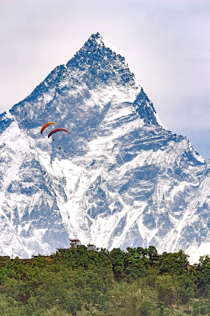

Search for paragliding near Pokhara and every answer points to the same ridge. Sarangkot, the 1,592 meter hill directly west of the city, is where every commercial tandem flight in the Pokhara Valley begins, and with more than two dozen registered operators flying every clear morning, it has earned Pokhara its reputation as the paragliding capital of Nepal and a place among the world's top tandem destinations.
But the experience of flying here is much bigger than one launch meadow. Once airborne, a tandem crosses terraced hillsides, village rooftops, and the open water of Phewa Lake, with the white dome of the World Peace Pagoda below and the Annapurna range filling the horizon. On the ground, the ridges that ring the valley, Kaskikot, Naudanda, Dhampus, and the Panchase hills, reward travelers who want the same panoramas on foot. And within a few hours by road, two more launch sites, Bandipur and Kushma, can turn a single flight into a proper flying trip.
This guide maps all of it for 2026: what lies beyond Sarangkot, what each flight product actually covers, what it costs, when to fly, and how to combine a morning tandem with the region's best treks.
Quick answer: Every commercial tandem flight near Pokhara takes off from the Sarangkot ridge at 1,592 meters, so "beyond Sarangkot" is not about a second launch. It is the wider flying landscape: the Kaskikot and Naudanda ridgelines, the World Peace Pagoda above Phewa Lake, the quieter eastern shore at Begnas, and, within a few hours by road, the alternative launch sites at Bandipur and Kushma.
Is Sarangkot Really the Only Launch Near Pokhara?
Yes. Sarangkot is the only commercial tandem launch in the Pokhara Valley. The site is managed by the Nepal Paragliding and Hang Gliding Association, its launch zone is shared by multiple licensed operators, and if your booking says Pokhara paragliding, you will still go to Sarangkot for takeoff.
Sarangkot sits on the ridge directly west of Pokhara, roughly a 30 minute jeep ride up from the Lakeside district. Formerly a separate village, it became Ward 18 of Pokhara when the city absorbed the surrounding settlements in 2015. The same ridge also hosts the famous sunrise viewpoint, so combining a dawn viewpoint visit with a morning flight is both possible and highly recommended. Tour operators, booking platforms, and even some travel blogs use "Pokhara paragliding" and "Sarangkot paragliding" interchangeably, which creates real confusion for first-time visitors, but the practical answer never changes: one launch, one ridge, dozens of teams. For the full site story, read our dedicated Sarangkot tandem flights guide and our Pokhara vs Sarangkot comparison, which untangles the two names travelers mix up most.
What Does "Beyond Sarangkot" Actually Mean?
Beyond Sarangkot means three things: the landscape you fly over once you are airborne, the ridges and lakeshores you can explore on foot on your non-flying days, and the genuinely different launch sites, Bandipur and Kushma, that sit close enough to add a second flight to one trip.
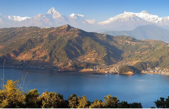
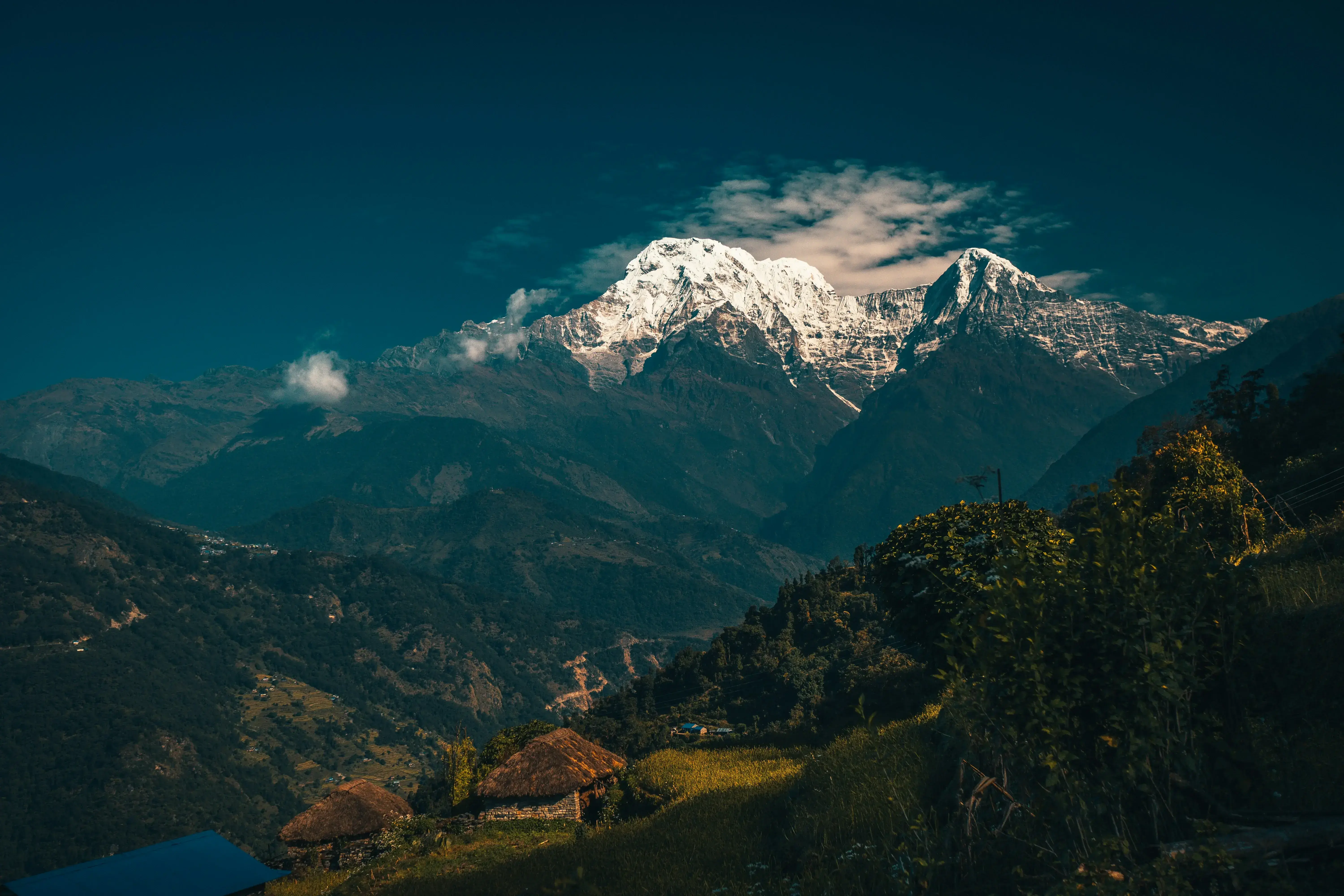
Think of the Pokhara Valley as a single flying bowl. Phewa Lake sits at the center. To the west, the linked ridge of Sarangkot, Kaskikot, and Naudanda forms the sunny wall where the morning thermals first build. To the south, Anadu Hill carries the white World Peace Pagoda above the lakeshore. To the east lie the quieter waters of Begnas and Rupa, the valley's second pair of lakes. To the north and southeast, the trekking ridges of Dhampus, Australian Camp, and Panchase climb through forest and terraces toward the high Annapurna foothills. A visitor who only stands on the Sarangkot launch meadow sees one slice of this bowl. A visitor who flies it, hikes its ridges, and drives to its far shores gets the whole picture, and that is the purpose of this guide.
Which Ridges and Landmarks Do You Actually Fly Over?
A standard tandem leaves the launch meadow, soars over terraced farmland and village rooftops, crosses Phewa Lake toward its southern shore, and lands beside the water in the Lakeside district. Longer cross country flights climb in thermals above the ridge before gliding down across the valley.

The typical flight path has become one of the most recognizable aerial routes in Asia. You soar past terraced farmland, villages, and forested hillsides before crossing over Phewa Lake, with unobstructed views of the Annapurna range, Machhapuchhre, the sacred twin-peaked Fishtail mountain, and, on clear days, Dhaulagiri far to the west. The final minutes are the postcard moment: the glider banks across the open water, the Lakeside landing zone appears on the shoreline, and your pilot flares gently onto the grass a short walk from the lakeside restaurants. Every operator runs this route in the morning window, which is why the skies above the lake fill with colorful wings between roughly 9 AM and noon in peak season.
What Is the Kaskikot and Naudanda Ridge?
Kaskikot and Naudanda are the villages along the ridgeline that runs north from Sarangkot above the northwest corner of Phewa Lake. Kaskikot is now Ward 24 of the Pokhara metropolitan city, while Naudanda sits on the road toward Sarangkot with open Annapurna views.
Kaskikot, commonly known simply as Kaski, was for generations a separate village development committee, and its hilltop still carries traces of that history, including old palace ruins and a ridge temple that appear on walking trails above the village. Naudanda, a quieter farming village on the same ridgeline, is a favorite sunrise stop precisely because it looks straight down the valley toward the peaks. Neither village is a launch site, and no commercial tandem takes off from them, but the ridge matters to every flight that leaves Sarangkot. The sun-facing slopes along this line warm quickly in the morning, the thermals that lift longer cross country flights build along it, and passengers on extended routes regularly watch this ridge slide past beneath their feet. Travelers who prefer keeping both boots on the ground can walk or ride sections of the ridge in half a day, starting from Sarangkot or from the Naudanda roadhead.

Why Does Nearly Every Pokhara Flight Cross Phewa Lake?
Phewa Lake lies directly between the Sarangkot launch and the Lakeside landing zone, so almost every tandem finishes with a crossing of the water. Phewa is the largest lake in Gandaki Province and the most visited lake in Nepal, formerly called Baidam Tal.
The lake's administrative footprint actually includes parts of both Sarangkot and Kaskikot on its western side, which is a neat way of saying that the launch, the water, and the landing zone all belong to one connected landscape. On still mornings the surface mirrors the ridgeline and, when the air is exceptionally clear, the white face of Machhapuchhre itself, a reflection photographers chase from wooden dinghies long before any glider launches. From the air, the crossing is the calm heart of the flight: the noise of the launch meadow falls away, the colorful doonga boats shrink below, and the Annapurna range hangs ahead as if painted above the far shore. For many passengers this two or three minute glide over water is the single moment they remember years later.

What Is the World Peace Pagoda Flight Path?
The Pokhara Shanti Stupa, a white Buddhist peace monument on Anadu Hill, watches over the southern shore of Phewa Lake. Many tandems bank past its dome on the final glide toward Lakeside, making it one of the most photographed moments of any flight.
The stupa stands on Anadu Hill in the former Pumdi Bhumdi village lands, directly opposite the Sarangkot ridge across the water. That geometry is what makes it central to the flight experience: gliders leaving the launch drift south along the valley, pass above or beside the gleaming white dome ringed by pines, and then descend to the landing zone. It is a reliable, crowd-free way to see the monument. If you would rather visit on foot, a well-marked trail climbs from the lakeside dam up through forest to the stupa, usually taking 60 to 90 minutes each way, and the view from the top looks back up at the very ridge you would fly from the next morning. Many travelers split the two: hike to the pagoda on a free afternoon, then fly past it the following morning.

What Lies on the East Side of the Valley: Begnas and Rupa?
Begnas Lake, the second largest of the valley's seven lakes, and neighboring Rupa Lake sit on the quieter eastern side of Pokhara. No tandem operation launches there, so treat them as the calm counterweight to busy Lakeside rather than a flying site.
Begnas lies southeast of the city center, a short taxi or local bus ride from Lakeside, and its water level rises and falls with the seasons as rainfall and irrigation draw on the lake. Where Phewa's shore hums with boats, bars, and booking offices, Begnas stays a working landscape of fishing families, rice paddies, and small guesthouses, with Rupa, quieter still, tucked in the forest just beyond it. The honesty section of any good guide should say plainly: nothing here launches gliders, and you should not book anything sold as "Begnas paragliding." What Begnas offers instead is the valley at its most local, plus a genuine question worth asking on any multi-day stay: since flights launch at Sarangkot in the west, the eastern lakes are the one part of the bowl you will not cross in the air, so seeing them by road rounds out the map.

Can You Paraglide From Dhampus or Australian Camp?
No. Dhampus and Australian Camp, on the northern rim of the valley, are trekking viewpoints rather than launch sites, so no commercial tandem flies from them. Both pair naturally with a Sarangkot flight, either the evening before or the morning after.
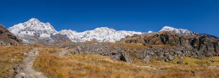
Dhampus is a classic trailhead village in Kaski District, reached by a short drive off the Pokhara to Baglung highway, and it sits right on the route of the Mardi Himal trek, where the trail first climbs out of the terraces into rhododendron forest. Australian Camp, a ridge-top clearing above Dhampus, opens one of the fullest Annapurna panoramas available anywhere in the valley, and simple lodges let you sleep with that view outside the window. The pattern that works beautifully: take an early vehicle to Dhampus, walk up to Australian Camp for sunset, overnight in a lodge, watch the range catch first light at dawn, then descend and return to Pokhara in time for a late-morning or next-day tandem from Sarangkot. You trade nothing away, since the flight and the ridge walk show you the same valley from two completely different altitudes.


What Is Panchase, and Why Do Fliers Care About It?
Panchase is the forested ridge that rises southeast of the valley, anchoring one of the region's quietest multi-day treks through Gurung villages, terraces, and ridge-top forest. It is not a launch site, but it walks you through the same foothills you fly over.
From the Sarangkot launch meadow you can watch the Panchase ridgeline roll away to the southeast, and from the air on the southern glide the valley opens toward that same line of hills. Walking it is a different tempo entirely: the Panchase Panorama trek crosses a part of the Annapurna foothills that sees a fraction of the traffic on the busier Poon Hill circuit, which makes it a strong pick for a second, slower Annapurna experience after your flight. Trekkers sleep in small village lodges, climb through mossy forest to the Panchase summit clearing, and watch dawn break over the same peaks they circled under a parachute a few days earlier. For travelers building a week around Pokhara, the pairing of one morning in the air with three or four days walking this ridge is about as complete as an Annapurna foothills trip gets.
How Much Do Paragliding Flights Near Pokhara Cost in 2026?
A standard 20 to 30 minute tandem costs NPR 8,500 to 12,000. Cross country and sunrise thermaling flights run NPR 12,000 to 15,000, roughly USD 90 to 150 depending on duration and operator, and photo and video packages add USD 15 to 25.
The table below collects the 2026 price bands used across our Nepal paragliding guides, so you can budget a Pokhara flying morning, or a whole flying week, with confidence. Bookings through registered operators typically include hotel pickup from Lakeside, jeep transport up to the launch, the flight itself, insurance coverage, and your photo and video files delivered digitally.
| Flight product | Duration | Typical altitude band | 2026 price |
|---|---|---|---|
| Standard tandem from Sarangkot | 25 to 35 minutes | 1,800 to 2,200 m | NPR 8,500 to 12,000 (USD 70 to 90) |
| Cross country tandem | 45 to 60 minutes | 2,500 to 3,000 m | NPR 12,000 to 15,000 (USD 110 to 150) |
| Sunrise thermaling session | 40 to 55 minutes | 2,000 to 2,500 m | USD 90 to 120 |
| Photo and video package | Flight length | Not applicable | USD 15 to 25 |
| Tandem flights elsewhere in Nepal | 15 to 45 minutes | Site dependent | NPR 5,000 to 12,000 |
For the full national picture, including how these figures compare across every major site, see our complete paragliding in Nepal guide.
Which Flight Should You Book: Standard, Cross Country, or Sunrise Thermaling?
Book the standard tandem for a first flight, the sunrise thermaling session for photography and calm air, and the cross country tandem for the longest airtime if you do not mind thermal bumps. Most travelers choose the standard 25 to 35 minute option.
The standard tandem is the workhorse product: launch, soar the ridgeline, cross Phewa Lake, land at Lakeside, all inside half an hour of leaving the meadow. It suits anyone from nervous first-timers to families, and its gentle morning conditions are the most forgiving in Nepal. The cross country tandem stretches the same flight to 45 or 60 minutes by climbing in thermals to between 2,500 and 3,000 meters, riding the ridge lift longer before crossing the valley, and it is the choice if you want to actually feel what paragliding is rather than just see the view. The sunrise thermaling session launches in the earliest, stillest window of the day, when the light turns the Annapurna range gold and the air is at its smoothest, which is why photographers and repeat flyers book it. One practical note: thermal flying involves turning circles in rising air, so if you are prone to motion sickness, the standard or sunrise products will treat you more kindly than the cross country route.
When Is the Best Season to Fly Around Pokhara?
The flying season runs from October through May. October and November bring the clearest post-monsoon air, March and April the strongest thermals, and winter the thinnest crowds, while the June to September monsoon grounds all but roughly 30 to 40 percent of mornings.
Autumn is the peak for a reason: the monsoon washes the dust from the sky, the newly snow-capped peaks stand razor sharp, and gentle, predictable thermals carry even standard tandems a little longer than usual. Winter is the underrated window, with weaker lift but bone-clear air, quiet launch meadows, and pilots who have more flexibility with departure times. Spring delivers the strongest thermal activity of the year, which cross country pilots love, though afternoon cloud buildup can curtail flights by one or two in the afternoon in April and May, so morning slots matter most. The monsoon limits operations to occasional weather windows between rain systems, and anyone traveling in those months should build two or three possible flying mornings into an itinerary and treat every confirmed flight as a bonus.
| Season | Months | Conditions | Flying quality |
|---|---|---|---|
| Autumn | September to November | Cleanest air, steady gentle thermals | Peak season, book ahead |
| Winter | December to February | Cooler, lighter winds, very clear air | Excellent, thin crowds |
| Spring | March to May | Strongest thermals, building afternoon haze | Very good, fly early |
| Monsoon | June to August | Rain systems, unstable air, poor visibility | Only if flexible |

Is Paragliding Near Pokhara Safe for Beginners?
Yes. Tandem flying around Pokhara is beginner safe when you book a CAAN registered operator. Every pilot is licensed by the Civil Aviation Authority of Nepal, carries a reserve parachute, and gives passengers a 10 to 15 minute briefing before launch.
The regulatory picture in Pokhara is the most mature in the country. The Civil Aviation Authority of Nepal registers every tandem operator, enforces equipment standards, and issues the flight permits that pair each passenger with a licensed pilot. Operators carry insurance, run radio communication between launch and landing, and hold backup landing options in case conditions shift mid-flight. Weather calls are made conservatively: pilots will not launch in strong winds, rain, fog, or poor visibility, and flights are cancelled whenever wind speeds at takeoff exceed roughly 25 km/h, with the decision always erring toward safety. If your flight is cancelled, reputable operators rebook you on the next clear morning or refund in full with no penalty. One addition worth making yourself: confirm that your own travel insurance explicitly covers paragliding, since not all standard policies do. For a reliable, government-registered experience, book through the Enticing Himalayas paragliding in Nepal page.
Where Else Can You Fly Within a Day of Pokhara?
Bandipur and Kushma. Bandipur, a preserved Newari hill town halfway between Kathmandu and Pokhara at 1,030 meters, offers quieter cultural flying, while Kushma, above the Kali Gandaki gorge, pairs paragliding with the world's second highest bungee jump.
Bandipur sits right on the Kathmandu to Pokhara road, so you can stop for a flight en route in either direction, and its small operator scene of three to five teams keeps the launch peaceful compared with Sarangkot's busy mornings. Flights drift over terraced hills and Gurung and Magar villages, and the restored Newari bazaar street below makes the town itself a destination. Kushma, the headquarters of Parbat District just a couple of hours west of Pokhara, is the adrenaline option: paragliding launched there in 2021 over the deep Kali Gandaki gorge, and the same site hosts a 228 meter bungee jump, so a single day can stack a flight, a jump, and a swing. Beyond both, Nepal's far-western hills hold emerging expedition sites for pioneers, and travelers flying home via Kathmandu can add the capital's own launches at Chandragiri and Godavari. Read the full guides: Bandipur paragliding, Kushma paragliding, and our top 10 paragliding sites ranking.
How Do You Combine Paragliding With Trekking Around Pokhara?
Fly on your first or second morning in Pokhara while your schedule still has slack, keep one backup morning for weather, and start the trek afterwards. The classic pairings are Ghorepani Poon Hill, Mardi Himal, Khopra, and the Annapurna Base Camp treks.
The logic is simple: flights launch in the morning, treks take days, so the flight always goes first. The Ghorepani Poon Hill trek sends you up to the famous sunrise viewpoint on the border of Myagdi and Kaski, sleeping in the village of Ghorepani at about 2,874 meters inside the Annapurna Conservation Area, where a national park permit is required. The Mardi Himal trek climbs from the Dhampus trailhead for a short ridge adventure under Machhapuchhre. The Khopra trek and the full Annapurna Base Camp trek push deeper into the same range you fly beside, and the Panchase Panorama trek keeps everything close to the valley. If you would rather leave the planning to a single booking, the Kathmandu and Pokhara cultural scenic tour and the full Nepal tour package list include Pokhara stops that pair naturally with a flying morning.

What Should You Pack for a Paragliding Morning?
Sturdy shoes with ankle support, long layers, sunglasses, and sunscreen cover almost every flight. Winter mornings start cold at 1,592 meters, so add a warm mid-layer and lightweight gloves, and leave loose valuables at your hotel.
Your operator provides the wing, harness, helmet, and everything that actually flies, so your job is simply to dress for a cold morning that turns warm. Comfortable closed shoes matter more than anything else in your bag, because you will run a few steps at launch and land on your feet at Lakeside. A light jacket or fleece handles the temperature gap between the launch meadow and the landing zone, and sunglasses take the glare off both the snow and the lake. Phones fly happily in secure zip pockets, and most pilots mount action cameras for the photo and video packages, but glasses without straps, dangling jewelry, and loose hats should stay behind. The standard passenger weight range is 30 to 100 kilograms, about 66 to 220 pounds, so travelers near either end should confirm with their operator when booking, since glider model and wind conditions shape the final call.
Who Should Choose Pokhara Over Other Nepali Flying Sites?
Choose Pokhara if you want the easiest logistics and the widest choice, with more than two dozen registered operators flying daily from a single managed launch. Choose Bandipur for quiet, Kushma for adrenaline stacked with bungee, and the far west for pioneering terrain.
First-time paragliders belong at Sarangkot: no other site in Nepal combines reliable morning conditions, deep operator competition that keeps standards high, and the safest, most forgiving terrain for a first flight. Photographers should target the sunrise thermaling window or the classic golden-hour light on the Annapurna range. Travelers with only a day or two in Kathmandu can instead fly the capital's own sites at Chandragiri or Godavari, covered in our Kathmandu paragliding guide and our Chandragiri launch article. And visitors drawn to truly empty skies should read about the far-western emerging sites before committing to the standard circuit. For everything else, from the Pokhara destination guide to the complete national overview, our Pokhara paragliding guide and complete Nepal paragliding guide cover the ground this article deliberately leaves to them.
Frequently Asked Questions
Can you paraglide anywhere near Pokhara besides Sarangkot?
All commercial tandem flights in the Pokhara Valley launch from Sarangkot, so every booked flight takes off there. The other ridges around the valley, including Kaskikot, Naudanda, and the World Peace Pagoda ridge, are scenery you fly over or hike, not separate launch sites. For a second launch, add Bandipur or Kushma.
How much does paragliding near Pokhara cost in 2026?
A standard 20 to 30 minute tandem from Sarangkot costs NPR 8,500 to 12,000. Longer cross country and sunrise thermaling flights run NPR 12,000 to 15,000, roughly USD 90 to 150. Photo and video packages add USD 15 to 25. Prices include hotel pickup from Lakeside, transport, equipment, insurance, and a licensed pilot.
What do you actually see on a Pokhara paragliding flight?
After launching from the 1,592 meter Sarangkot ridge, you soar over terraced farmland and Gurung villages, cross the shoreline of Phewa Lake, and bank past the white World Peace Pagoda on Anadu Hill. Ahead stand Machhapuchhre, Annapurna South, Hiunchuli, and, on clear days, Dhaulagiri.
When is the best season for paragliding around Pokhara?
The flying season runs October through May. October and November bring the clearest air and gentle thermals, while March and April deliver the strongest lift for cross country flights. Winter offers thin crowds and crystalline visibility, and the monsoon, June to September, limits flying to roughly 30 to 40 percent of mornings.
Is tandem paragliding in Pokhara safe for beginners?
Yes. Tandem paragliding around Pokhara is safe for first timers when you fly with a CAAN registered operator. Every pilot holds a Civil Aviation Authority of Nepal license, carries a reserve parachute, and briefs passengers for 10 to 15 minutes before launch. Pilots cancel flights whenever winds exceed roughly 25 km/h or visibility drops.
What is the weight limit for paragliding in Pokhara?
The standard passenger weight range for tandem flights in Pokhara is 30 to 100 kilograms, about 66 to 220 pounds. Heavier passengers should confirm limits with their operator when booking, since glider models and wind conditions affect the final call. Sturdy shoes and a warm layer matter more than fitness for the flight itself.
Where Should You Read Next?
This article is part of our complete paragliding series covering every flying site in Nepal. Continue with the Pokhara paragliding destination guide, the Sarangkot tandem flights guide, the Pokhara vs Sarangkot comparison, and the top 10 paragliding sites in Nepal, or start from the full paragliding in Nepal guide.
Ready to fly? Book a government-registered tandem flight through the Enticing Himalayas paragliding in Nepal page, or browse the full tour package list to combine your Sarangkot flight with trekking across the Annapurna region. Explore, Heal, Thrive.