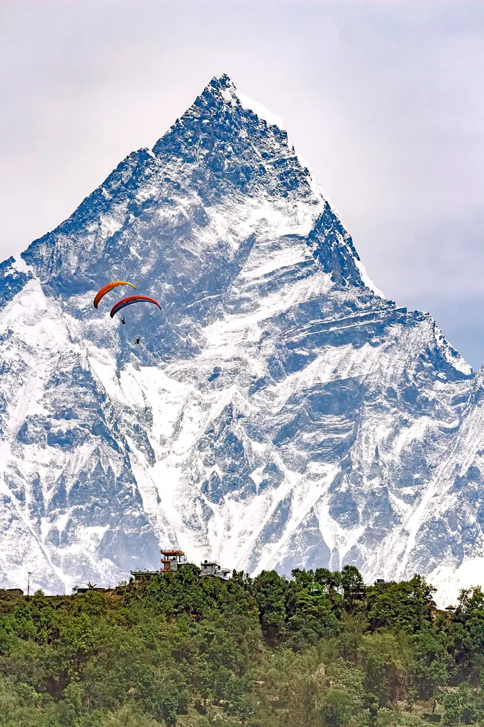
Annapurna Paragliding: A Bird's Eye View of Nepal's Signature Range
Annapurna paragliding is the closest most travelers will ever get to flying wingtip to wingtip with the Himalaya. Every day in season, tandem wings launch from the Sarangkot ridge above Pokhara and drift out over the Pokhara Valley with the full Annapurna massif spread across the northern sky. Few paragliding landscapes on earth combine a warm lakeside city, a 1,592 meter launch ridge, and an unbroken panorama of peaks above 7,000 meters, all within a twenty minute drive of your hotel. This guide explains where Annapurna paragliding actually happens, what you will see from the air, what it costs, when to fly, and how to pair a flight with the region's classic treks. It is written the way we would tell a friend: honestly, with real numbers, and without inventing launches that do not exist.
Quick answer: Annapurna paragliding means a tandem flight from Sarangkot, the ridge launch above Pokhara and the region's only established commercial takeoff. A standard 20 to 30 minute flight costs NPR 8,500 to 12,000 and glides over the valley below Annapurna I, Dhaulagiri, and Machhapuchhre. There is no commercial tandem operation deeper inside the region, so Pokhara is the gateway, and pairing your flight with an Annapurna trek is the classic move.

What Makes the Annapurna Region Nepal's Signature Flying Landscape?
The Annapurna region stacks every ingredient a flying site dreams of into one compact corner of Nepal. A launch ridge sits high above a warm valley floor, the world's tenth highest mountain anchors the view, and a lake city of 600,051 people (2021 census) supplies hotels, operators, and infrastructure at the landing end.
Geologically, Nepal rises in staircase bands, and the Annapurna region compresses all of them into a short flight. The southernmost Sivalik Hills, also called the Churia range, form the outer Himalaya. Behind them the Mahabharat Range, averaging 3,700 to 4,500 meters, carries the mid-country hill towns like Bandipur. Furthest north stands the Great Himalaya, with more than one hundred peaks above 7,200 meters, including the Annapurna and Dhaulagiri massifs. The Annapurna Conservation Area, Nepal's largest protected area at 7,629 square kilometers, spans everything from 790 meters in the valley floors to the 8,091 meter summit of Annapurna I, spread across Manang, Mustang, Kaski, Myagdi, and Lamjung districts.
Pokhara, the Gandaki Province capital and Nepal's second-largest city, is routinely called the country's capital of tourism. Sarangkot, a ward of Pokhara since the 2015 municipal merger, stands on a ridge at 1,592 meters. Because Phewa Lake sits at roughly 742 meters, the launch meadow hangs about 850 vertical meters above the landing zone, which is precisely the elevation drop a paraglider needs for a long, glide-heavy flight. Few commercial sites anywhere offer that geometry with an eight-thousander in the background.

Where Do Annapurna Paragliding Flights Actually Launch?
Every commercial tandem flight in the Annapurna region launches from Sarangkot, the grassy takeoff meadow on the ridge west of Pokhara. That is the honest answer, and it matters: there is no second commercial launch in the valley, and no commercial tandem operation deeper inside the region at Manang, Jomsom, or Muktinath.
In practice the routine is simple. Operators collect passengers from Lakeside hotels in the morning, drive forty minutes up the ridge road to the takeoff, lay out the wing, clip the passenger into a comfortable seated harness in front of the pilot, wait for a clean cycle, and run a few steps into the air. From there the flight typically crosses the ridges toward Phewa Lake, may swing past the white dome of the World Peace Pagoda on Anadu Hill, and finishes with a gentle landing on the shoreline or a lakeside meadow. The full experience, hotel to hotel, takes about half a day, and the airborne portion 20 to 30 minutes on a standard booking.
If you are choosing where to fly in Nepal, our Pokhara destination guide covers the city's operator scene in detail, our Sarangkot launch site guide walks through the takeoff and landing, and Paragliding Near Pokhara: Beyond Sarangkot profiles the ridges and viewpoints that surround the single launch. For the full national picture, start with the complete guide to paragliding in Nepal.
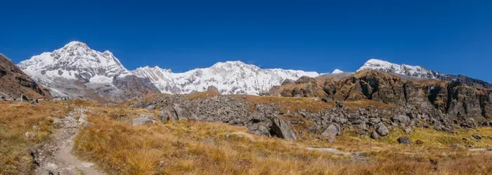
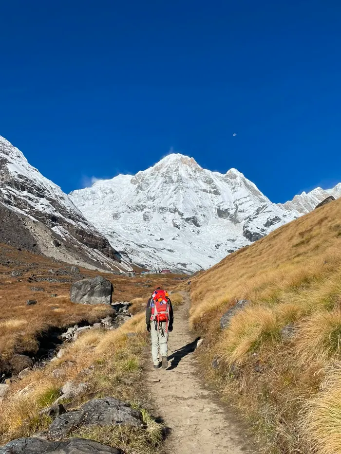
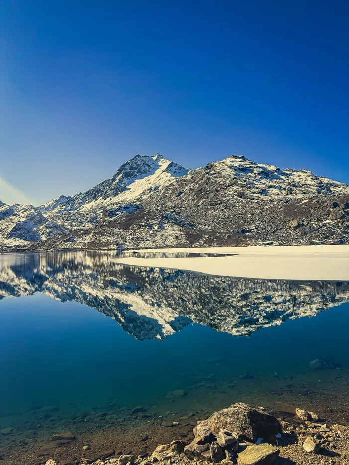
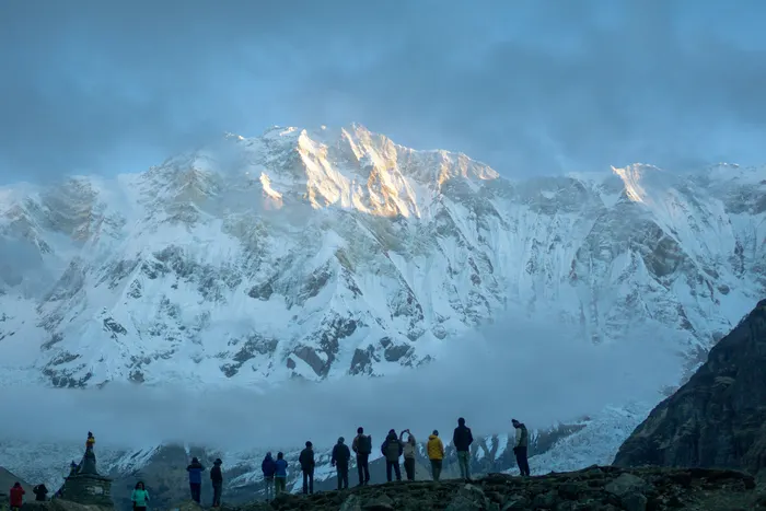

What Will You See from the Air over the Annapurna Foothills?
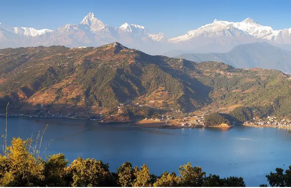
From the air between Sarangkot and Phewa Lake you are looking at the western ramparts of the Annapurna range: Annapurna I, Dhaulagiri, Annapurna South, and the unmistakable fishtail of Machhapuchhre, plus a foreground of terraced fields, ridge villages, and the lake itself.
The signature peaks line up like a museum wall:
| Peak | Elevation | What makes it special |
|---|---|---|
| Annapurna I | 8,091 m | 10th highest mountain in the world, the giant of the range you fly beneath |
| Dhaulagiri | 8,167 m | 7th highest, and the highest mountain lying entirely within one country's borders; first climbed 13 May 1960 |
| Annapurna South | 7,219 m | The massive southern wall that dominates the view from the launch ridge |
| Machhapuchhre | twin summits | The sacred fishtail peak; climbing permits have never been granted, so it remains officially unclimbed |
Annapurna I and Dhaulagiri stand only 34 kilometers apart, and the Kali Gandaki River flows between them through the deepest gorge in the world, a detail you can appreciate later from the circuit trail. Closer in, the flight path usually crosses Kaskikot, the old ward 24 ridge line of Pokhara, and the rural stretch toward Naudanda, both of which hikers also walk for sunrise views. On a clear October morning the air is so sharp that the snow textures read clearly from launch altitude, and the World Peace Pagoda's white dome flashes below as you bank toward the lake.

How Much Does Annapurna Paragliding Cost?
Annapurna paragliding prices cluster tightly around the Pokhara benchmark: expect NPR 8,500 to 12,000 for a standard 20 to 30 minute tandem, and NPR 12,000 to 15,000 for longer cross-country and thermal flights of 45 to 60 minutes.
| Flight option | Duration | Price |
|---|---|---|
| Standard tandem from Sarangkot | 20 to 30 min | NPR 8,500 to 12,000 (about USD 65 to 95) |
| Cross-country or thermal tandem | 45 to 60 min | NPR 12,000 to 15,000 (roughly USD 90 to 150) |
| Photo and video package | add-on | USD 15 to 25 |
| National tandem range for context | varies | NPR 5,000 to 12,000 across Nepal's sites |
Most Sarangkot operators bundle hotel pickup from Lakeside, ridge transport, equipment, a pre-flight briefing, and basic passenger insurance into the quoted price, which is why the Pokhara price sits slightly above the national floor. Confirm before paying whether the media package, the GoPro footage and stills, is included or costs extra. For comparison, Kathmandu Valley sites (Godavari, Chandragiri, Phulchowki, and Kakani) quote in the USD 70 to 140 band, covered in our Kathmandu paragliding guide, and the full national ranking is in Top 10 Paragliding Sites in Nepal Ranked.
When Is the Best Season for Annapurna Paragliding?
The prime windows are October and November, straight after the monsoon clears the atmosphere, and March into April, when spring warming restarts the thermal engine and the rhododendron forests bloom below launch.
| Season | Flying conditions | Verdict |
|---|---|---|
| October to November | Clearest air of the year, stable post-monsoon weather, daily flyable mornings | Best overall: book ahead, it is peak trekking season too |
| December to February | Crisp clear days but cold at launch, shorter daylight, stronger valley inversions | Good for views; dress warmly and take the first flights of the day |
| March to April | Warming thermals, blooming hillsides, occasional pre-monsoon haze building late | Second-best window and excellent for longer thermal flights |
| June to September | Monsoon cloud, rain, and unstable air; fleets mostly grounded | Avoid; plan a trek instead and fly on your next visit |
Within any flyable day, the schedule follows the sun. Morning starts are the default because the light is best on the range and the air is smoothest; if your travel dates are fixed, booking the first or second launch slot of the day maximizes your chance of flying at all, since afternoon overdevelopment cancels more flights than rain does. Season planning matters more here than at most sites because the Annapurna views that justify the price disappear entirely in monsoon cloud.
Why Do Annapurna Paragliding Flights Start in the Morning?
Annapurna flights launch on a daily clock set by the sun: a gentle anabatic breeze carries wings up the slopes through the morning, midday thermals offer lift to experienced pilots, and a katabatic flow rolls back down in the evening to close the day.
An anabatic wind, from the Greek for moving upward, is the warm daytime breeze that flows up sun-heated slopes in calm, clear weather; it is the conveyor that helps a loaded tandem wing clear the ridge after takeoff. Thermals, rising masses of buoyant air created by the sun's uneven heating of the surface, then build through the middle of the day. A trained pilot reads the flat-based cumulus clouds as a map: the flat base marks the condensation level, effectively the day's usable ceiling, and a line of them, a cumulus street, marks a road of lift you can follow for kilometers. By late afternoon the pattern reverses, cool dense air drains downslope as a katabatic wind, and the flying day ends.
Tandem passengers feel this clock as rhythm rather than drama: a smooth morning glide, a few soft bumps if the pilot works a thermal, and a lazy descent to the lake. If you want the deep dive into how Nepal's terrain builds lift, read The Geography of Nepal's Paragliding Sites: Why Thermals Matter, our cluster companion on the science behind the schedule.
Can You Fly over the Annapurna Sanctuary or Higher into the Range?
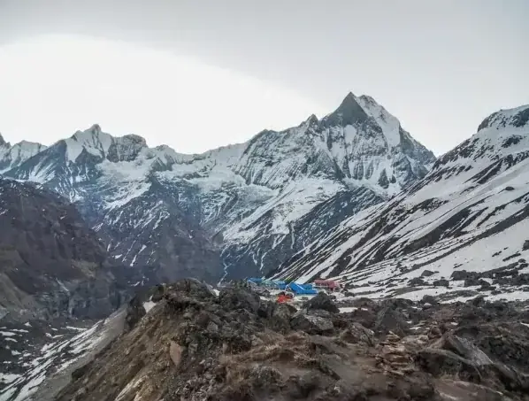
Not commercially, and any operator claiming otherwise should be avoided. The Annapurna Sanctuary is a high glacial basin lying 40 kilometers directly north of Pokhara, an oval plateau above 4,000 meters ringed by the range, and no tandem operation flies tourists into it. Commercial Annapurna paragliding is a foothills experience, full stop.
That does not make the high country irrelevant to your trip; it makes it the sequel. The Annapurna Base Camp trail climbs through the Sanctuary's gates over several days, sleeping in teahouses below the same walls you saw from the air. Further east, the Annapurna Circuit, 160 to 230 kilometers depending on the variant, crosses the 5,416 meter Thorong La pass in the Damodar Himal, drops into the arid Mustang district, and passes Jomsom, the windy administrative headquarters at about 2,700 meters on the Kali Gandaki. Along that river's banks trekkers find shaligram fossils, venerated as symbols of Vishnu, and at its upper end stands Muktinath, the ancient temple sacred to both Hindus and Buddhists that gives the district its spiritual weight.
Ambitious pilots have privately flown big lines from high points in the region, and ultralight aircraft offer scenic flights from Pokhara, but for a traveler booking today the honest statement is: tandem paragliding stays in the valley, and the Sanctuary and the pass belong to your boots. If emerging and expedition-style flying interests you, our guide to paragliding in Nepal's Far West covers how new sites actually develop, and our Annapurna Circuit Trek (10 Days) and Annapurna Base Camp Trek (10 Days) packages are the classic ways to earn the high views on foot.


Which Annapurna Treks Pair Best with a Paragliding Flight?
Fly on your first morning in Pokhara, then walk: the flight needs half a day and slots neatly in front of any itinerary, so the pairing question is really which walk you want underneath you afterward.
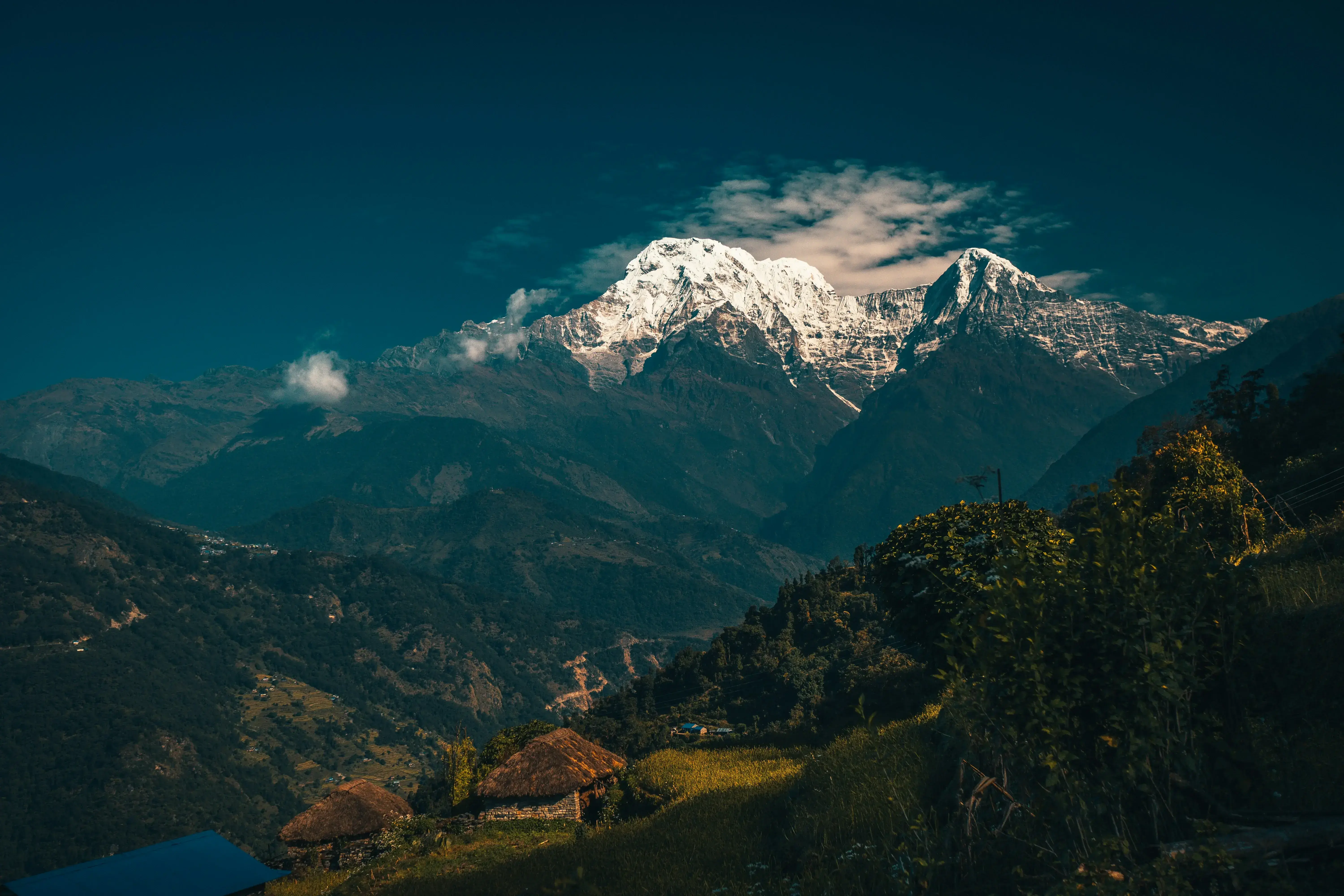
The short classic is the Ghorepani Poon Hill Trek (7 Days), whose sunrise viewpoint sits on the Myagdi-Kaski border with Ghorepani village at about 2,874 meters inside the conservation area. Ridge lovers should look at the Mardi Himal Trek (5 Days), which climbs the ridge directly behind your flight path, starting through Dhampus, the village about 19 kilometers off the Pokhara-Baglung highway that anchors the Panchase Panorama Trek as well. The 7-Day Khopra Trekking Adventure adds a higher ridge viewpoint beyond Poon Hill with fewer crowds, and the full Annapurna Base Camp Trek (10 Days) reaches the Sanctuary itself. Travelers who want mountains without multi-day walking can pair the flight with the Nepal Cultural and Scenic Tour: Kathmandu and Pokhara, and the full catalog is on our tour list.
The order matters for weather, not logistics. Flying first means you have flexibility to shift the flight a day if the morning clouds in, while your trek departure stays fixed; trekking first risks arriving back in Pokhara to a canceled last-morning flight. Local knowledge is unanimous on this point: book the flight early in your stay.

Is Annapurna Paragliding Safe for First-Time Flyers?
Yes, for the overwhelming majority of passengers: tandem paragliding is built around people who have never flown, launches are a run rather than a jump, and Sarangkot's commercial pilots fly the same line daily in season.
The passenger's job is small and well rehearsed. At takeoff you run a few steps down the slope as the pilot brings the wing overhead; in the air you sit in the harness and take photographs; at landing you lift your legs slightly so the pilot touches down first. Operators brief all of it before launch, and reputable companies include passenger insurance in the quoted price. The genuine risk factors are external: weather that turns mid-flight, which is why commercial pilots launch in the smoothest morning hours and cancel liberally, and medical conditions like uncontrolled heart problems or pregnancy, which operators screen for. Disclose honestly at booking.
Choosing well matters more than worrying. Book through an established operator with visible pilot certification, current wings, and a real office in Lakeside rather than a beach promoter, and ask whether the pilot holds a commercial tandem rating. If you want the broader safety picture across Nepal's sites, including insurance norms and operator vetting, our complete paragliding guide carries a full section, and you can book the flight itself through our paragliding activity page.
What Should You Wear and Bring for an Annapurna Tandem Flight?
Dress for a brisk hillside morning with wind: closed walking shoes, long trousers, a warm layer for launch altitude, sunglasses, and sunscreen are the working kit list for a Sarangkot tandem.
Launch sits about 850 meters above the lake, so even a warm Lakeside morning is chilly on the ridge before the sun climbs, and the temperature drops slightly in the air. A light fleece or jacket that closes at the front, so it does not flap into the pilot's line of sight, solves it. Gloves help in the December-to-February window. Leave loose items, scarves, unstrapped hats, and dangling cameras, with the operator's staff or zipped away; anything that can fly free into the wing is a genuine hazard, which is why most companies fit phones and GoPros to pilot-mounted fixtures. If you are prone to motion sickness, take a remedy before pickup: tandem flights are smoother than a bus ride but bank and bump when the pilot works lift.
How Do You Photograph the Annapurna Range in Flight?
Two ways, and the best trips use both: hand the photography to the pilot's mounted GoPro for the wide drama, and keep your phone on a wrist strap for a few framed shots of the range and the wing.
The geometry favors the passenger seat. You fly facing forward with the Annapurna range ahead and the wing above and behind, so the classic composition is simple: keep the horizon level, put the white peaks in the top third, and let the orange canopy edge into the top corner of the frame. Morning light comes from the east, the same side as the range, so the snow is fully lit on a standard flight. Shoot short bursts rather than long video, lock your phone's exposure on the snow so the peaks do not blow out, and clean the lens before takeoff; ridge dust is the quiet killer of paragliding photographs. If the media package matters to you, confirm at booking that the pilot flies with a GoPro and that files are delivered the same day, since packages typically add USD 15 to 25.
How Does Annapurna Paragliding Compare with Nepal's Other Flying Scenes?
Annapurna paragliding wins on view quality and infrastructure; the alternatives win on novelty, price, or convenience depending on where you already are in Nepal.
The Kathmandu Valley scene, spread across Godavari, Chandragiri, Phulchowki, and Kakani, quotes USD 70 to 140 and suits travelers whose itinerary never reaches Pokhara; the trade is valley haze and a city skyline under the wing rather than an eight-thousander wall. Bandipur, the hill town on the Mahabharat ridge between the capitals, offers a quieter, smaller operation with old-newari streets at the landing end, profiled in our Bandipur paragliding guide. Kushma, deep in the Kali Gandaki gorge far to the west, pairs tandem flights with the world's second-highest bungee and undercuts the Pokhara price. Nothing else in the country matches the pure spectacle of a clear Sarangkot morning with Annapurna I on the skyline, which is precisely why this valley, and not any of those others, is where Nepal's paragliding industry actually concentrates.
What Is the Honest Verdict on Annapurna Paragliding?
Fly it. Annapurna paragliding is one of the few adventure activities anywhere that genuinely delivers the brochure: a twenty minute airtime window with Annapurna I, Dhaulagiri, and Machhapuchhre in one frame, for a mid-double-digit dollar price, an hour from a comfortable hotel bed.
Manage three expectations and it will not disappoint. First, this is a foothills flight, not a Himalayan penetration; the Sanctuary and the high passes belong to treks, and the honest pairing is exactly that, fly on day one, walk after. Second, it is weather-dependent, so book the earliest slot and early in your stay, giving yourself slack days in both October-November and March-April. Third, the standard 20 to 30 minute flight is the right product for almost everyone; pay up for the longer thermal flight only if you already know you love being aloft, because the views are the same wings, just more minutes of them. For travelers building a fuller Nepal itinerary, browse the complete tour catalog, explore the Pokhara destination guide, or reserve through the paragliding in Nepal activity page. Explore, Heal, Thrive.
Frequently Asked Questions about Annapurna Paragliding
Can you paraglide in the Annapurna region?
Yes. Commercial tandem flights launch from Sarangkot on the ridge above Pokhara, the region's established launch, and glide over the Annapurna foothills with views of Annapurna I, Dhaulagiri, and Machhapuchhre. There is no commercial tandem operation deeper inside the region, so Pokhara is the practical gateway.
How much does an Annapurna tandem flight cost?
A standard 20 to 30 minute tandem from Sarangkot costs NPR 8,500 to 12,000, roughly USD 65 to 95. Longer cross-country and thermal flights of 45 to 60 minutes run NPR 12,000 to 15,000. Photo and video packages add USD 15 to 25, and prices usually include hotel pickup from Lakeside, gear, and insurance.
When is the best time to fly over the Annapurna foothills?
The clearest and most reliable months are October and November, after the monsoon, followed by March and April in spring. Morning flights between 9 a.m. and 11 a.m. usually offer the calmest air before thermals build. The summer monsoon from June to September brings clouds, rain, and grounded fleets.
Is paragliding in the Annapurna region safe for beginners?
Tandem flights are designed for first-time flyers, and passengers run a few steps at launch rather than jumping. Pilots flying the Pokhara scene hold commercial tandem ratings and fly daily in season. Choose a licensed operator, disclose any medical condition, and follow the pre-flight briefing on harness, running, and landing position.
Do you need a permit to paraglide in the Annapurna region?
No trekking permit is needed for a tandem flight over the Pokhara Valley. Permits only apply if your trip continues into the Annapurna Conservation Area, where the ACAP entry fee and a TIMS card are required for routes like the Annapurna Base Camp trek or the circuit. Operators handle flight paperwork.
Can you combine paragliding with Annapurna treks?
Yes, and it is a natural pairing. Fly on your first or last day in Pokhara, then trek the Ghorepani Poon Hill circuit, Mardi Himal ridge, Khopra danda, or the full Annapurna Base Camp route. A morning flight needs only half a day, so it slots easily before any trekking itinerary.