Paragliding in the Everest Region: Is It Possible?
Paragliding in the Everest region is one of the most searched and least served questions in Nepali adventure travel. Travellers see photographs of wings above the Khumbu, read about record flights from the world's highest summit, and assume there must be a booking desk in Lukla or Namche Bazaar waiting for them. There is not. Understanding why is the difference between a wasted detour and a well planned trip that combines world class trekking with a tandem flight somewhere the sport is actually established.
Quick answer: Paragliding in the Everest region is physically possible and has been done, including a 1988 descent from the summit by Jean-Marc Boivin. But there is no established commercial tandem operation in the Khumbu. Flights here are private, expedition grade, and reserved for highly experienced pilots with their own wings, permits, and support. If you want a guaranteed tandem flight, fly in Pokhara, Kathmandu, Bandipur, or Kushma, and keep the Everest region for trekking.

Is Paragliding in the Everest Region Actually Possible?
Yes, in the strict sense it is possible. A paraglider is an aircraft and the Khumbu is airspace like any other, so a qualified pilot with the right permissions can fly here. The confusion arises because "possible" and "bookable" are two very different words. Nothing in the Everest region is sold as a consumer tandem product, and no operator based in Lukla, Namche, or Gorak Shep advertises passenger flights.
So treat this guide as a reality check rather than a booking page. It explains what has actually been flown, why the commercial scene never developed, what an expedition would involve, and what to do instead if your real goal is simply to see the world's highest mountains from the air. That last point matters, because there are excellent aerial alternatives in the region that carry none of the risk of a high altitude launch.
Who Has Actually Flown a Paraglider in the Everest Region?
The landmark flight belongs to Jean-Marc Boivin, the French mountaineer, extreme skier, hang glider and paraglider pilot who died in 1990 while BASE jumping off Angel Falls. Boivin was the first person to paraglide from the summit of Mount Everest, and he held several altitude records for hang gliding and paragliding during a career that also included the first winter solo of the Eiger north face and a string of first ski descents in the Alps.
His Everest descent is the proof of concept that every later claim rests on. It also sets the bar. Boivin was not a tourist who added a flight to a holiday. He was a professional alpinist and aviator who had spent two decades building the skills to climb to 8,848.86 metres and then launch a wing from there. Since his flight, a small number of expedition pilots have flown in the Khumbu, almost always as part of a climbing or filming project rather than as a standalone flying holiday.

Why Is There No Commercial Tandem Paragliding in the Khumbu?
Four practical problems keep the tandem business out of the Khumbu, and none of them have easy answers.
The air is thin. A wing generates lift from the air flowing over it, and at altitude there is simply less air per cubic metre. To create the same lift, a paraglider must fly faster, which means a longer and faster run at launch and a higher stall speed throughout the flight. Launching at 5,000 metres is not a scaled up version of launching at Sarangkot. It is a different discipline.
The wind is often unusable. The Khumbu sits close to the jet stream, and the upper level winds that make Everest such a serious climb also make a fabric wing a liability. Reliable flying windows are short, seasonal, and early in the day. A commercial operation needs predictable daily departures, and the Khumbu cannot supply them.
There are almost no landing zones. Below Sarangkot you land beside Phewa Lake on open ground. Below Kala Patthar you have glacier, moraine, boulder fields, and cliffs. The Khumbu Glacier alone runs from roughly 4,900 metres at its terminus to 7,600 metres at its source, and it is crevassed and moving. A forced landing is not an inconvenience here. It is an emergency.
The paperwork and insurance do not exist for it. Nepal's tandem industry is built around designated sites with local agreements, trained tandem pilots, and insurers who understand the risk. None of that framework exists for passenger flights in the Khumbu, and no responsible operator would sell a seat without it. This is why paragliding in Nepal is concentrated in the mid hill sites rather than the high Himalaya.
How Does Altitude Change Paraglider Performance?
Paragliding is the sport of flying a lightweight, free flying, foot launched glider with no rigid primary structure. The pilot hangs in a harness below a fabric wing, and the wing keeps its shape through air pressure entering the front vents plus the aerodynamic forces of air flowing over the outside. Every part of that description depends on air density, and air density falls steadily as you climb.
The practical consequences stack up quickly. Your wing needs a higher true airspeed to produce the same lift, so it launches faster and lands faster. Your indicated airspeed stays familiar while your ground speed rises, which can flatter a pilot into thinking everything is normal. Turn radius grows, thermals feel sharper and narrower, and the margin between a comfortable flight and a collapse shrinks. Add cold, dehydration, and reduced oxygen to the pilot and the error rate climbs while the tolerance for error falls.
This is also why the region's own geography matters so much. The trail to Everest Base Camp climbs from Lukla at about 2,860 metres to Namche Bazaar at 3,440 metres, then to Dingboche at around 4,410 metres, Gorak Shep at 5,164 metres, and South Base Camp at 5,364 metres. Trekkers acclimatise over days. A pilot who steps out of a helicopter at 5,000 metres and tries to launch has done none of that adaptation.
What Are the Flying Conditions Like in the Khumbu?
The Khumbu runs on the same daily cycle as the rest of Nepal's flying terrain, but with the dial turned up. In calm sunny weather, warm air moves upslope as an anabatic wind through the morning, which is what carries gliders up from a launch. As the sun heats the surface unevenly, thermals form: rising masses of buoyant air, convective currents that a pilot can circle in to gain height. In the evening the cycle reverses and cool, dense air drains downslope as a katabatic wind, which ends the flying day.
Ridge lift adds to the picture. Wind deflected upward by a ridge or cliff will lift a wing along the face, provided the slope is large and steep enough to turn the flow upward. The best conditions combine that baseline ridge lift with thermals coming off the sunniest spurs. In the Khumbu, the ridges are enormous and the spurs are snow covered, so the lift is powerful but the air is also rougher and colder than anywhere in the mid hills.
Cumulus clouds give the honest read on the day. Their flat bases mark the condensation level, which is effectively the ceiling of usable lift. A line of cumulus, sometimes called a cumulus street, can be followed for kilometres. Towering cumulus congestus is the warning sign: the day is too strong, and the sensible decision is to land early. In the Khumbu, the sensible decision is usually made before launch.

Where Could a Paraglider Launch in the Everest Region?
If a private expedition were assembling a launch list, these are the realistic candidates. Each comes with a caveat, and the caveats matter more than the altitudes.
| Launch candidate | Approx. elevation | Reality check |
|---|---|---|
| Kala Patthar | 5,545 m | The classic Everest viewpoint above Gorak Shep. Exposed, rocky, and one of the highest plausible launches anywhere on the trek. |
| Gokyo Ri | About 5,350 m | A steep summit above the Gokyo Lakes, with the Ngozumpa Glacier below. Superb views, almost no safe landing. |
| Syangboche | 3,780 m | A small airstrip above Namche with extreme and capricious weather, heavy winds, fog and snowfall. Airspace conflict is a real concern. |
| Namche area ridges | 3,440 m and above | The most forgiving altitude band in the region, but still high, steep, and wooded on the lower slopes. |
| Tengboche and Pangboche | 3,800 to 4,000 m | Valley floor villages with monastery rooftops and trekkers everywhere. Not a launch site in any practical sense. |
The pattern is obvious once it is laid out. The best views sit at the highest, most exposed points, and those are precisely the places with the worst landing options and the longest rescue times. A pilot who launches from Kala Patthar has committed to flying in one of the most unforgiving environments on earth with no possibility of a casual retrieve.

What Permits and Paperwork Would You Need?
There is no standalone tourist paragliding permit for the Khumbu, because there is no tourist paragliding product to permit. What exists is the standard protected area and local government framework that every visitor enters, plus the aviation side that a pilot must satisfy separately.
On the ground, the region is managed through Sagarmatha National Park, established in 1976 and covering 1,148 square kilometres of Solukhumbu District, from 2,845 metres up to the 8,848 metre summit. It borders Makalu Barun National Park to the east and Qomolangma National Nature Preserve to the north. Visitors need a national park entry permit, and the local municipality, Khumbu Pasanglhamu, levies its own fee. Trekkers also carry a TIMS card. A pilot would add expedition insurance, a rescue and evacuation plan, and direct coordination with the relevant aviation authorities.
The human geography is worth understanding before any of that. Khumbu Pasanglhamu Rural Municipality covers 1,539 square kilometres with a population of about 9,133 at the 2011 census, ranging from roughly 1,900 metres at its lowest to 8,848 metres at its highest. Namche Bazaar, at 3,440 metres, is the administrative and trading hub, and most Sherpa families in the tourism business come from the surrounding villages of Thame, Khumjung, Pangboche, and Pheriche.

Is High Altitude Paragliding in Nepal Dangerous?
Yes, and the risk profile is different in kind from a Pokhara tandem, not just higher in degree. At 5,000 metres and above, hypoxia degrades judgement before the pilot notices it. Cold stiffens hands and slows reactions. A reserve parachute throw at that altitude, in strong wind over glacial terrain, offers far less margin than the same action over Phewa Lake.
Rescue is the other half of the equation. Helicopter evacuation exists in the Khumbu and is used routinely for trekking emergencies, but it depends on weather, visibility, and altitude performance. A pilot injured on a moraine at 5,000 metres may wait hours for a window. That is acceptable for a mountaineer who has planned for it. It is not acceptable for a passenger who booked a 20 minute joy flight.
The 2015 earthquake showed how quickly the region's assumptions can change. On 25 April 2015 a magnitude 7.8 earthquake triggered an avalanche on Pumori that swept through South Base Camp, killing at least 19 people, and a second magnitude 7.3 quake followed on 12 May. Trails were damaged and needed repair. More recently, in June 2022, authorities announced that Base Camp would be moved 200 to 400 metres lower because the Khumbu Glacier it sits on is thinning and becoming unsafe.

How Do You Reach the Everest Region?
Almost everyone starts with the flight to Lukla, at about 2,860 metres, where Tenzing-Hillary Airport has been rated the most dangerous airport in the world for more than 20 years by the television series Most Extreme Airports. The runway is short, sloped, and bracketed by terrain. It is also the gateway that roughly 40,000 people a year use to begin the trek to Base Camp.
From Lukla the trail follows the Dudh Kosi valley to Namche Bazaar, usually with an overnight stop, and then continues through Tengboche and Pangboche toward Dingboche and the upper valley. Above Namche there is also Syangboche, a small airstrip at 3,780 metres that is exposed to heavy winds, fog, and snowfall. Helicopters serve the region from Kathmandu and can reach Base Camp, Kongde, and the Gokyo valley, but they are weather dependent in exactly the same way aircraft are.
For walkers who want to avoid the Lukla flight entirely, the classic alternative is the long approach from Jiri, which adds roughly a week and a great deal of altitude gained properly. It is the traditional Hillary route and remains the most gradual way into the high country. Reliable trekking options are listed on the tour list, including a 21 day Everest Base Camp trek via Jiri.
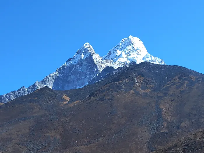

When Is the Best Time to Fly in the Everest Region?
The seasons that work for trekking roughly match the seasons that offer any flying window, with one important difference. Trekkers can walk in marginal weather. A paraglider cannot.
| Season | Months | Flying outlook |
|---|---|---|
| Post monsoon | October to November | The most stable window: clear skies, settled air, cold nights. Still windy aloft. |
| Pre monsoon | March to May | Warm, hazy afternoons, stronger thermals. Morning flights only. |
| Monsoon | June to September | Cloud, rain, leeches on the lower trail, and almost no reliable visibility. |
| Winter | December to February | Extreme cold, high winds, many lodges closed. Not a flying season. |
Even inside the good windows, the viable flying hours are narrow. The anabatic flow builds through the morning, thermals peak around midday, and the katabatic drain in the afternoon can shut a high valley down quickly. In practice, that means early starts and short missions, which is the opposite of how a commercial tandem schedule works.
If Not Paragliding, What Aerial Alternatives Exist?
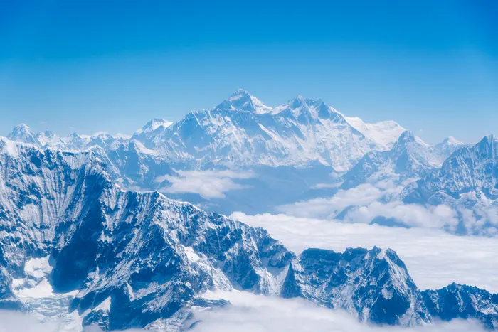
This is where the Everest region genuinely delivers, and it is the part most travellers should be reading. If your goal is to see Everest from above, you do not need a paraglider.
The simplest option is the mountain flight from Kathmandu, a fixed wing scenic tour that runs along the Himalaya and gives passengers a window view of the range. Enticing Himalayas offers this as a Mount Everest scenic flight with airport shuttle. It is short, weather dependent, and requires no fitness at all.
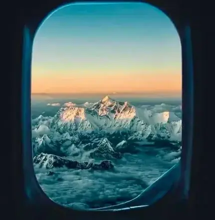
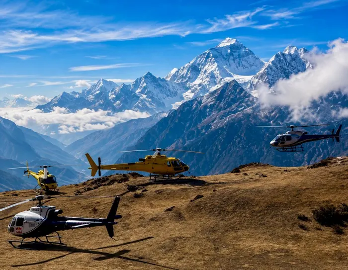
A step up is the helicopter. A trek up and fly back itinerary gives you the walk in and the aerial exit, which is the best of both worlds for travellers with limited time. Separately, a pure helicopter tour reaches Base Camp and the Khumbu icefall area without any trekking at all.
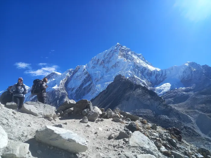
On foot, the viewpoints are the real prize. Kala Patthar gives the most accessible close view of Everest anywhere on the trek. Gokyo Ri looks over the Gokyo Lakes, a Ramsar site since 2007 covering 7,770 hectares of lakes and wetlands at 4,700 to 5,000 metres. A Gokyo Lakes and Everest Base Camp trek combines both, while the Everest Three Passes trek adds Kongma La, Cho La, and Renjo La for travellers who want the high routes.

How Does the Everest Region Compare With Nepal's Tandem Sites?
Comparing the Khumbu to Pokhara is not really a like for like comparison, but the price table is still the clearest way to see what you are choosing between.
| Location | Typical tandem price | Booking style |
|---|---|---|
| Sarangkot, Pokhara (20 to 30 min) | NPR 8,500 to 12,000 | Walk in or online, same day |
| Pokhara cross country (45 to 60 min) | NPR 12,000 to 15,000 | Pre-booked, weather dependent |
| Kathmandu Valley sites | USD 70 to 140 | Pre-booked, hotel pickup |
| Kushma | NPR 6,000 to 10,000 | Walk in, seasonal |
| Everest region | No retail price, expedition quoted | Private arrangement only |
Photo and video packages at established sites typically add USD 15 to 25, and a national benchmark for a standard tandem across Nepal sits between NPR 5,000 and 12,000 depending on the site and duration. Those figures are useful context, but they describe a regulated consumer product. The Everest region does not have one, and no honest operator will quote you a fare for it. If you want to understand the established scene in detail, the ranking of Nepal's paragliding sites is the right starting point.
What Would a Pilot Need to Bring for a Khumbu Expedition?
For completeness, and because this question comes up from qualified pilots rather than tourists, here is the realistic kit list. Nothing on it is optional.
| Item | Why it matters in the Khumbu |
|---|---|
| High altitude rated wing | Standard wings fly faster and closer to the edge when air density drops. |
| Supplementary oxygen | Hypoxia degrades judgement before the pilot recognises it. |
| Two reserves and a bailout plan | Landing options are glacier, moraine, or boulder field. |
| Satellite communicator | Mobile coverage is patchy above Namche. |
| Expedition insurance and evacuation cover | Helicopter rescue is weather and altitude dependent. |
| Acclimatisation schedule | Trekkers take days to adapt. Pilots cannot skip that process. |
What Is the Honest Verdict?
Paragliding in the Everest region is real, historically significant, and effectively closed to recreational travellers. The flights that have happened were expedition projects by elite pilots, and the conditions that made them remarkable are the same conditions that keep the tandem industry out. Anyone selling you a casual Khumbu tandem flight is either confused about where the Khumbu is or not being straight with you.
The good news is that the region does not need paragliding to be extraordinary. Walking to Base Camp, climbing Kala Patthar for the closest view of Everest, crossing Cho La to the Gokyo Lakes, or taking a helicopter out of the valley all deliver the aerial perspective people are actually chasing. Book the flying where flying is done properly, in Pokhara or the Kathmandu Valley rim, and give the Khumbu the time it deserves on foot.
If you are building an Everest itinerary, the Solukhumbu overview is a useful next read, and the 10 day Everest Base Camp express trek is the fastest supported route for travellers with a tight calendar. For a gentler introduction to the same views, the 5 day Everest View short trek reaches Namche and the surrounding panorama without committing to Base Camp altitude.
Related Reading From the Paragliding Series
- Paragliding in Nepal: the complete 2026 guide to tandem flights and safety
- The geography of Nepal's paragliding sites and why thermals matter
- Paragliding in the Annapurna region: a bird's eye view
- Pokhara vs Sarangkot: which paragliding launch is better
- Paragliding in Kathmandu: sites, costs and what to expect
Frequently Asked Questions
Is paragliding in the Everest region possible?
Yes, in the strict sense it is possible. French pilot Jean-Marc Boivin paraglided from the Everest summit in 1988, and expedition grade pilots have flown in the Khumbu since. However, there is no commercial tandem operation based in the region, so a tourist cannot simply book a flight the way you can in Pokhara.
Can I book a tandem paragliding flight in the Everest region?
No. No established commercial tandem operator runs flights from Lukla, Namche Bazaar, or Everest Base Camp. Tandem flying in Nepal is concentrated in Pokhara, Kathmandu, Bandipur, and Kushma. For a guaranteed tandem, book one of those sites and treat the Khumbu as a trekking and expedition destination instead.
How much does paragliding in the Everest region cost?
There is no fixed retail price because no commercial tandem product exists. A private expedition would be quoted individually, covering pilot fees, permits, porter support, oxygen, and insurance. For reference, a Pokhara tandem costs NPR 8,500 to 12,000, Kathmandu sites USD 70 to 140, and Kushma NPR 6,000 to 10,000.
What is the best time of year to fly in the Khumbu?
The stable windows are October to November and March to May, when skies clear after the monsoon and before it returns. Winter brings extreme cold and strong upper winds. The monsoon months of June to September bring cloud, rain, and limited visibility. Even in good seasons, flying windows are short and morning biased.
Why is there no tandem paragliding at Everest Base Camp?
Altitude is the main reason. At 5,364 metres the air is thin enough that wings need much higher ground speed to generate lift, and winds near the jet stream are frequently too strong. Landing zones are glacier, moraine, or boulder fields, and rescue options are limited. Insurance and regulation add further barriers.
What aerial alternatives can I book in the Everest region instead?
You can book a Kathmandu to Everest scenic flight, a helicopter tour, or a trek that climbs to Kala Patthar or Gokyo Ri for the same views from the ground. Enticing Himalayas runs Everest Base Camp treks, Gokyo Lakes treks, and helicopter return options that reach the same viewpoints without any flying risk.