Manaslu Circuit Trek Overview
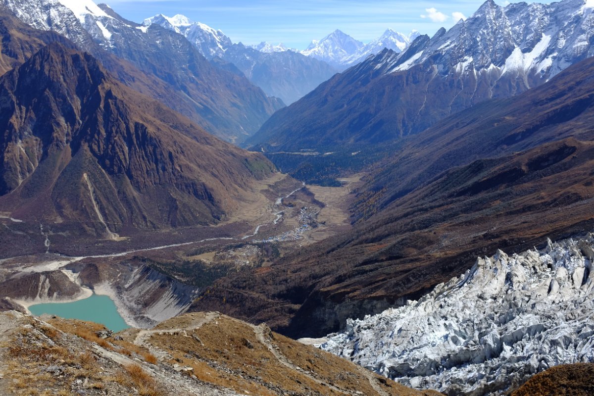
The Manaslu Circuit Trek is one of the most spectacular and culturally rich trekking routes in Nepal. Circling the eighth highest mountain in the world, Mount Manaslu (8,163m), this trek takes you through diverse landscapes ranging from lush subtropical forests to high altitude desert terrain. The route crosses the formidable Larkya La Pass at 5,160m, offering breathtaking panoramic views of Himlung Himal, Cheo Himal, and the Manaslu massif itself. Over the course of 14 days, trekkers traverse the Budhi Gandaki River gorge, pass through traditional Tibetan Buddhist villages, and experience a way of life that has remained largely unchanged for centuries.
The trek begins with a long drive from Kathmandu to Soti Khola, a small settlement in the Gorkha district. From there, the trail follows the Budhi Gandaki River upstream through dense forests, over suspension bridges, and past cascading waterfalls. As you gain elevation, the landscape transforms dramatically. The lower valleys are blanketed in green forests of pine and rhododendron, while the higher regions feature arid, rocky terrain reminiscent of the Tibetan plateau. The Manaslu region was opened to trekking only in 1991 and remains a restricted area, requiring a special permit. This has kept the trail less crowded than the more popular Annapurna and Everest circuits, making it ideal for trekkers seeking solitude and an authentic wilderness experience.
The Manaslu Circuit is a tea house trek, meaning basic lodging and meals are available in villages along the route. However, facilities are simpler than on the Annapurna or Everest trails. Rooms typically have two single beds with foam mattresses and a shared bathroom. Hot showers are available in some lodges for an additional fee. Meals consist mainly of dal bhat (rice and lentils), noodles, potatoes, and Tibetan bread. Trekkers should carry supplementary snacks and be prepared for more basic conditions as they ascend higher into the valley.
Best Time to Trek the Manaslu Circuit
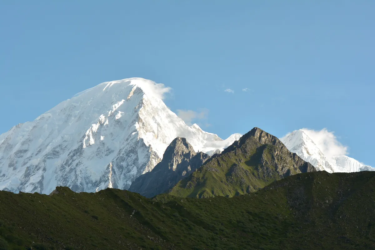
The optimal seasons for the Manaslu Circuit Trek are spring (March to May) and autumn (September to November). During these months, the weather is generally stable, skies are clear, and temperatures are moderate. Spring brings blooming rhododendrons and warmer days at lower elevations, while autumn offers the clearest mountain views after the monsoon has settled the dust. Winter trekking is possible but challenging, as the Larkya La Pass may be blocked by snow, and temperatures at higher altitudes can drop well below freezing. The monsoon season from June to August brings heavy rainfall, leeches, and slippery trails, making it the least favorable time for this trek.
Required Permits
Trekking the Manaslu Circuit requires several permits. The Manaslu Restricted Area Permit is mandatory and costs USD 100 per person for the first week during autumn and USD 75 per person per week during other seasons, with additional daily rates beyond the first week. Trekkers also need the Manaslu Conservation Area Permit (MCAP) which costs NPR 3,000 for foreign nationals, and the Annapurna Conservation Area Permit (ACAP) costing NPR 3,000, as the trail exits through the Annapurna region at Dharapani. These permits are checked at multiple checkpoints along the route, so they must be carried at all times.
Day 1: Drive from Kathmandu to Soti Khola
Distance: 126 km by road
Elevation: 700m at Soti Khola
Duration: 6 to 7 hours by jeep
The journey begins with a rugged overland drive from Kathmandu to Soti Khola. The road follows the Prithvi Highway westward before turning north toward Gorkha and then descending into the Budhi Gandaki valley. The drive is long and bumpy, passing through terraced farmland, small towns, and sections of dirt road carved into the hillside. The final stretch follows the Budhi Gandaki River through a narrow gorge. Soti Khola is a small village with a few tea houses where trekkers spend the first night. The sound of the river rushing below provides a fitting backdrop for the adventure ahead. After settling into a lodge, enjoy a warm meal and rest well, as the actual trekking begins the next morning.
Day 2: Soti Khola to Machha Khola
Distance: 14 km
Elevation gain: 700m to 870m
Duration: 6 to 7 hours
The first day of trekking follows the Budhi Gandaki River through subtropical forest. The trail crosses several suspension bridges and passes through the villages of Khani Besi and Tatopani, where natural hot springs offer a welcome opportunity to soak tired feet. The path alternates between gentle riverside walking and short climbs over ridges. The air is warm and humid at this elevation, and the forest is alive with birdsong and the occasional langur monkey swinging through the canopy. Lunch is typically taken at a trailside teahouse in Lapu Besi or Kholabesi. The day ends at Machha Khola, a small settlement named after the river that runs through it (Machha Khola means Fish Stream). A few basic lodges provide accommodation for the night.
Day 3: Machha Khola to Jagat
Distance: 14 km
Elevation gain: 870m to 1,340m
Duration: 6 to 7 hours
From Machha Khola, the trail continues up the Budhi Gandaki valley, crossing the river on a suspension bridge and climbing steadily to the village of Khorlabesi. The path then descends back to the river and follows it to Tatopani (a different one from the previous day). After a short section along the riverbank, the trail climbs a stone staircase to the village of Jagat. Jagat is a checkpoint village where trekkers must show their restricted area permits. The village has a distinctly Tibetan feel, with stone houses, prayer flags, and mani walls lining the trail. The transition from Hindu lowlands to Buddhist highlands becomes noticeable here. Several good teahouses are available, and the village offers views of the valley below.
Day 4: Jagat to Deng
Distance: 12 km
Elevation gain: 1,340m to 1,860m
Duration: 5 to 6 hours
Leaving Jagat, the trail descends to the river and crosses a long suspension bridge before climbing to the village of Philim. Philim is a prosperous Gurung village with a school, health post, and well-maintained houses. The trail continues through a narrow gorge, one of the most dramatic sections of the trek, where the Budhi Gandaki has carved a deep canyon through the rock. The path is cut into the cliffside in places, adding a sense of adventure. After passing the village of Salleri, the trail crosses the river again and reaches the small settlement of Deng. Deng marks the transition into the Nubri Valley, and the cultural landscape becomes more Tibetan. There are a few basic tea houses here with simple rooms and meals.
Day 5: Deng to Namrung
Distance: 13 km
Elevation gain: 1,860m to 2,630m
Duration: 6 to 7 hours
The trail from Deng climbs steadily through forest of pine and fir, crossing the Budhi Gandaki several times via suspension bridges. The path passes through the villages of Rana and Bihi Phedi before reaching Bihi, a small Tibetan settlement with a gompa (monastery). As you continue climbing, the forest thins and views of the surrounding peaks begin to open up. The village of Namrung sits at 2,630m and offers the first clear views of Mount Manaslu. The village is compact and traditional, with flat-roofed stone houses and barley fields terraced into the hillside. The change in architecture and culture is striking compared to the lower valleys. Tea houses in Namrung are comfortable, and the evening views of Manaslu glowing at sunset are a highlight of the day.
Day 6: Namrung to Lho
Distance: 11 km
Elevation gain: 2,630m to 3,180m
Duration: 5 to 6 hours
From Namrung, the trail climbs through a beautiful forest of birch and rhodendron, passing the village of Barchham and then descending slightly to the village of Lihi. The scenery becomes more alpine with each step, and the air noticeably thinner. Views of Manaslu and the neighboring peaks of Naike Peak and Pangboche Cheo become more prominent. The trail then climbs steadily to the village of Lho, perched on a ridge at 3,180m. Lho is home to Ribung Gompa, a small monastery with ancient murals and prayer wheels. A short climb above the village leads to a viewpoint with an excellent panorama of Manaslu. Teahouses in Lho are basic but adequate, and the village's elevated position provides stunning morning views of the mountain bathed in early light.
Day 7: Lho to Samagaon
Distance: 9 km
Elevation gain: 3,180m to 3,520m
Duration: 4 to 5 hours
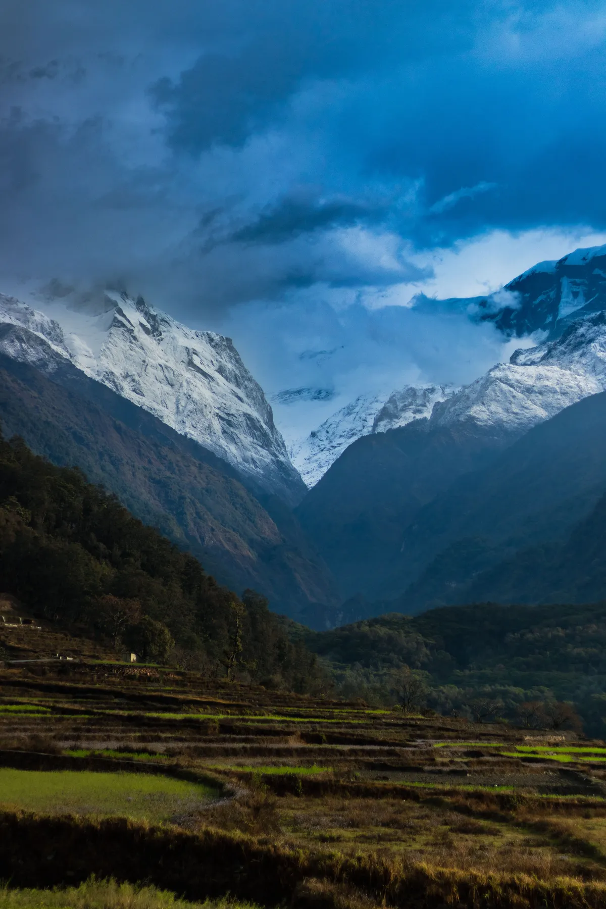
The trek from Lho to Samagaon is relatively short, allowing trekkers to arrive early and begin adjusting to the altitude. The trail follows a gradual ascent through alpine meadows and past yak grazing pastures. The village of Shyala is passed along the way, a small cluster of houses surrounded by towering peaks. From Shyala, the trail crosses a plateau with expansive views of Manaslu and the surrounding massif. Samagaon, at 3,520m, is the largest village in the Nubri Valley and an important stop for acclimatization. The village is situated directly at the base of Manaslu and has several tea houses, a gompa, and a small clinic. The setting is spectacular, with Manaslu dominating the skyline to the south and the village surrounded by barley fields and stone walls.
Day 8: Acclimatization Day in Samagaon
Elevation: 3,520m (with day hike to 4,300m+)
Duration: Full day
An acclimatization day in Samagaon is essential before continuing higher. The principle of climbing high and sleeping low is best practiced by taking a day hike to a higher elevation and returning to sleep at Samagaon. A popular option is the hike to Manaslu Base Camp at 4,400m, which takes about 4 to 5 hours round trip. The trail to base camp crosses yak pastures and moraine, offering close-up views of the Manaslu Glacier and the massive north face of the mountain. Alternatively, trekkers can hike to Pung Gompa, a small hermitage at 4,050m perched on a hill above the village. The gompa offers panoramic views of the valley and surrounding peaks. Spend the afternoon resting, hydrating, and enjoying the views from Samagaon. This is also a good day to wash clothes, read, and socialize with other trekkers at the tea house. The body needs this day to produce more red blood cells and adapt to the reduced oxygen at this altitude.
Day 9: Samagaon to Samdo
Distance: 7 km
Elevation gain: 3,520m to 3,860m
Duration: 3 to 4 hours
The trek from Samagaon to Samdo is short but significant, as it brings trekkers to the last village before the Larkya La Pass. The trail descends slightly to cross the Budi Gandaki River, then climbs steadily through a broad valley with views of Manaslu and the surrounding peaks. The landscape is now fully alpine, with sparse vegetation, rocky ground, and occasional patches of scrub. Samdo, at 3,860m, is a traditional Tibetan village that was once an important trade post on the salt trading route between Nepal and Tibet. The village has a small gompa and a cluster of stone houses with flat roofs. A short climb above Samdo leads to a viewpoint where the border with Tibet is visible just a few kilometers to the north. Several tea houses provide accommodation, though facilities are more basic than in Samagaon. Arrive early and take a short afternoon walk to aid acclimatization.
Day 10: Acclimatization Day in Samdo
Elevation: 3,860m (with day hike to 4,500m)
Duration: Full day
A second acclimatization day is strongly recommended before attempting the Larkya La Pass. The body needs additional time to adapt to the altitude, and a rest day in Samdo greatly increases the chances of a successful crossing. The recommended day hike is toward the Larkya La Pass direction, climbing to approximately 4,500m before turning back. This hike follows the trail that will be used the next day, allowing trekkers to preview the terrain and gauge the difficulty. The path climbs through a rocky valley with views of Samdo far below and the snow-capped peaks of the Manaslu range towering above. Alternatively, a shorter hike can be taken to the old trade route toward Tibet, which offers cultural interest and views of the high plateau. Return to Samdo by early afternoon, rest, hydrate, and eat a hearty dinner. Pack bags early and get to bed by early evening, as the next day starts before dawn.
Day 11: Samdo to Dharmasala via Larkya La Pass
Distance: 17 km
Elevation gain: 3,860m to 5,160m (pass), then descent to 4,460m
Duration: 8 to 10 hours
This is the most challenging and rewarding day of the Manaslu Circuit Trek. The day begins early, typically before sunrise, to ensure enough time to cross the pass before afternoon weather changes. The trail climbs steadily from Samdo through a rocky valley, crossing moraine and a possible snowfield depending on the season. The path is well defined but steep in sections, and the altitude makes every step feel more demanding. As you approach the pass, prayer flags come into view, marking the top of the Larkya La at 5,160m. The summit offers a breathtaking 360-degree panorama including Manaslu, Himlung Himal, Cheo Himal, Kang Guru, and the Annapurna II massif in the distance. On a clear day, the views are among the finest in the Himalaya.
After resting and taking photos at the pass, the descent begins on the western side. The trail drops steeply at first over loose scree and snow patches, then moderates as it follows a long valley down to the settlement of Dharmasala, also known as Larkya Phedi. At 4,460m, Dharmasala is a seasonal camp with a few basic shelters rather than a proper village. There is usually a simple lodge providing basic meals and a place to sleep. The combination of the long climb, the altitude, and the steep descent makes this a physically demanding day, and trekkers should be prepared mentally and physically. Carry extra water and high energy snacks for this day.
Day 12: Dharmasala to Bimthang
Distance: 16 km
Elevation descent: 4,460m to 3,720m
Duration: 5 to 6 hours
After the exertion of the pass crossing, the trail descends into a beautiful wide valley on the south side of the Manaslu range. The path follows the Dudh Khola (Milk River) downstream through a landscape of moraine and alpine meadows. As you descend, vegetation returns gradually, with shrubs and then trees appearing along the trail. The village of Bimthang, at 3,720m, is set in a broad plain surrounded by peaks including Manaslu North and Ngadi Chuli. The name Bimthang means plain of sand, and the flat open area is a welcome sight after days of narrow valleys and steep trails. Several good tea houses operate here, and the setting is one of the most scenic on the entire trek. This is an excellent place to rest and enjoy the mountain scenery.
Day 13: Bimthang to Tilije
Distance: 17 km
Elevation descent: 3,720m to 2,300m
Duration: 7 to 8 hours
The trail from Bimthang descends rapidly through a beautiful forest of rhododendron, oak, and pine. The path follows the Dudh Khola downstream, crossing it several times on suspension bridges. The air grows warmer and richer in oxygen with each hour of descent, and trekkers often notice a significant improvement in energy and mood. The trail passes through the village of Hompuk and then continues down through a narrow gorge to the village of Karche. From Karche, the trail climbs briefly over a landslide area before descending to the village of Tilije. Tilije, at 2,300m, is a prosperous village with apple orchards and well-built houses. The cultural shift is noticeable again, as the population here is a mix of Tibetan and Gurung people. Tea houses in Tilije are comfortable, and the warmer climate makes for a pleasant evening after the high altitude of the previous days.
Day 14: Tilije to Dharapani and Drive to Kathmandu
Distance: 6 km trek, then 118 km by road
Elevation descent: 2,300m to 1,970m at Dharapani
Duration: 2 hours trek, then 8 to 10 hours by road
The final trekking day is a short and pleasant walk from Tilije to Dharapani. The trail follows a dirt road for part of the way, descending gently through fields and small villages. Dharapani, at 1,970m, is a village on the Annapurna Circuit route and serves as the exit point from the Manaslu region. Here, trekkers must register at the Annapurna Conservation Area checkpoint. From Dharapani, a jeep or bus ride takes you down the Marsyangdi River valley to Besisahar and then on to Kathmandu. The drive is long but scenic, passing through terraced hillsides, river gorges, and small towns. Arriving back in Kathmandu marks the end of an unforgettable journey through one of Nepal's most remote and beautiful trekking regions.
Training and Fitness Preparation
The Manaslu Circuit Trek is a moderately difficult to challenging trek that requires a good level of physical fitness. Trekkers should be comfortable walking 6 to 8 hours per day on mountain trails with a daypack. The most demanding day is the Larkya La Pass crossing, which involves a long climb to over 5,000m followed by a steep descent. Preparing for the trek should include cardiovascular training such as hiking, running, or cycling for at least 2 to 3 months before departure. Strength training for the legs, core, and back is also beneficial. If possible, practice hiking with a loaded backpack on uneven terrain. The better your fitness, the more you will enjoy the trek and the lower your risk of altitude related problems.
Packing List for the Manaslu Circuit
A well prepared packing list is essential for a successful trek. Key items include a down jacket rated to at least minus 15 degrees Celsius, a four season sleeping bag, thermal base layers, a waterproof and windproof shell jacket, trekking pants, a warm hat and sun hat, gloves (both light and heavy), and multiple pairs of moisture wicking socks. Trekking poles are highly recommended, especially for the pass crossing and long descents. A headlamp with spare batteries is essential for the early morning start on pass day. Other important items include a first aid kit with Diamox for altitude sickness prevention, water purification tablets or a filter, high SPF sunscreen, lip balm, and a water bottle or hydration bladder. Pack all gear in a waterproof liner inside your duffel bag, as rain and snow can occur at any time.
Altitude Sickness and Safety
Altitude sickness is the primary health risk on the Manaslu Circuit Trek. The trail gains significant elevation over a relatively short period, and the Larkya La Pass at 5,160m is high enough to cause acute mountain sickness in susceptible individuals. Symptoms include headache, nausea, loss of appetite, dizziness, and difficulty sleeping. The best prevention is a gradual ascent with built in acclimatization days, as outlined in this itinerary. Staying well hydrated, avoiding alcohol, and eating adequately are all important. Diamox (acetazolamide) can be taken as a preventive measure starting one or two days before reaching high altitude. If symptoms worsen, the only effective treatment is immediate descent. Trekkers should inform their guide or companions of any symptoms immediately and not attempt to push through severe symptoms. Carrying a pulse oximeter to monitor blood oxygen levels can provide useful information about how your body is adapting.
Food and Water on the Trek
Meals on the Manaslu Circuit are provided by the tea houses along the trail. The staple meal is dal bhat, a combination of rice, lentil soup, and seasonal vegetables, which is nutritious and usually available in unlimited refills. Other common menu items include fried rice, chow mein noodles, Tibetan bread, pancakes, porridge, momos (dumplings), and various potato dishes. At higher altitudes, the menu becomes more limited and prices increase due to the cost of transporting goods. Boiled vegetables and pasta are common at higher elevations. For water, trekkers should carry purification tablets or a filtration system, as buying bottled water at every stop is expensive and environmentally unfriendly. Most tea houses provide boiled water for a small fee. Aim to drink at least 3 to 4 liters of water per day, especially at higher altitudes, to aid acclimatization and prevent dehydration.
Culture and Villages Along the Route
The Manaslu Circuit passes through a remarkable cultural landscape. The lower valleys are inhabited by Gurung and Magar people, ethnic groups of Tibeto Burman origin who practice a mix of Hinduism and Buddhism. As you climb higher into the Nubri Valley, the population becomes predominantly Tibetan Buddhist. Villages such as Namrung, Lho, Samagaon, and Samdo have a distinctly Tibetan character, with stone houses, mani walls, prayer wheels, and gompas. The people in these high villages trace their ancestry to Tibetan traders who settled here centuries ago. Religion plays a central role in daily life, and trekkers will see prayer flags fluttering from every rooftop and pass. Respect local customs by walking clockwise around mani walls and chortens, dressing modestly, and asking permission before photographing people. The cultural richness of the Manaslu region is as much a highlight as the mountain scenery, and taking time to learn about local traditions adds enormous depth to the trekking experience.
Why Choose the Manaslu Circuit
The Manaslu Circuit offers a rare combination of spectacular mountain scenery, rich cultural heritage, and genuine wilderness experience. Unlike the busier Annapurna and Everest regions, the Manaslu trail sees far fewer trekkers, allowing for a more peaceful and intimate journey through the Himalaya. The route encompasses an extraordinary range of landscapes, from subtropical river gorges to high altitude desert, and crosses one of the highest trekking passes in Nepal. The cultural immersion in Tibetan Buddhist villages, the close up views of Mount Manaslu, and the sense of accomplishment from crossing the Larkya La Pass make this trek a truly memorable adventure. For trekkers seeking an off the beaten path experience that combines physical challenge with cultural discovery, the Manaslu Circuit is an outstanding choice.