Paragliding in the Langtang Region: An Undiscovered Frontier
Langtang paragliding sits in the same category as many of Nepal's most searched adventure ideas: widely imagined, rarely explained. The valley lies barely 30 km as the crow flies from Kathmandu, its walls climb past 7,000 m, and a tandem wing would look spectacular above Kyanjin Gompa. Yet there is no booking desk, no price list, and no commercial operator waiting at Syabrubesi. This guide explains what actually exists in the Langtang region, what a private expedition would involve, and how to combine a Langtang trek with guaranteed tandem flying elsewhere in Nepal.
Quick answer: There is no established commercial tandem paragliding operation in the Langtang region, and no advertised price for a flight. Langtang National Park is a trekking and pilgrimage destination, not a flying destination. Flights here would be private, expedition grade affairs arranged with a licensed pilot, your own wing, park permits and full insurance. For a guaranteed tandem today, fly in Pokhara, Sarangkot, Kathmandu, Bandipur or Kushma, and treat Langtang as one of the finest trekking valleys in Nepal.

Is There Commercial Paragliding in the Langtang Region?
No. As of the 2026/27 season, no company sells passenger tandem flights anywhere inside the Langtang valley, and no operator is based at Syabrubesi, Lama Hotel, Langtang village, Kyanjin Gompa or Dhunche. Nepal's entire commercial tandem industry is concentrated in a handful of places with road access, reliable wind, a permanent pilot community and an insurance pathway: Pokhara, Sarangkot, the Kathmandu Valley, Bandipur and Kushma. Langtang has none of those conditions yet.
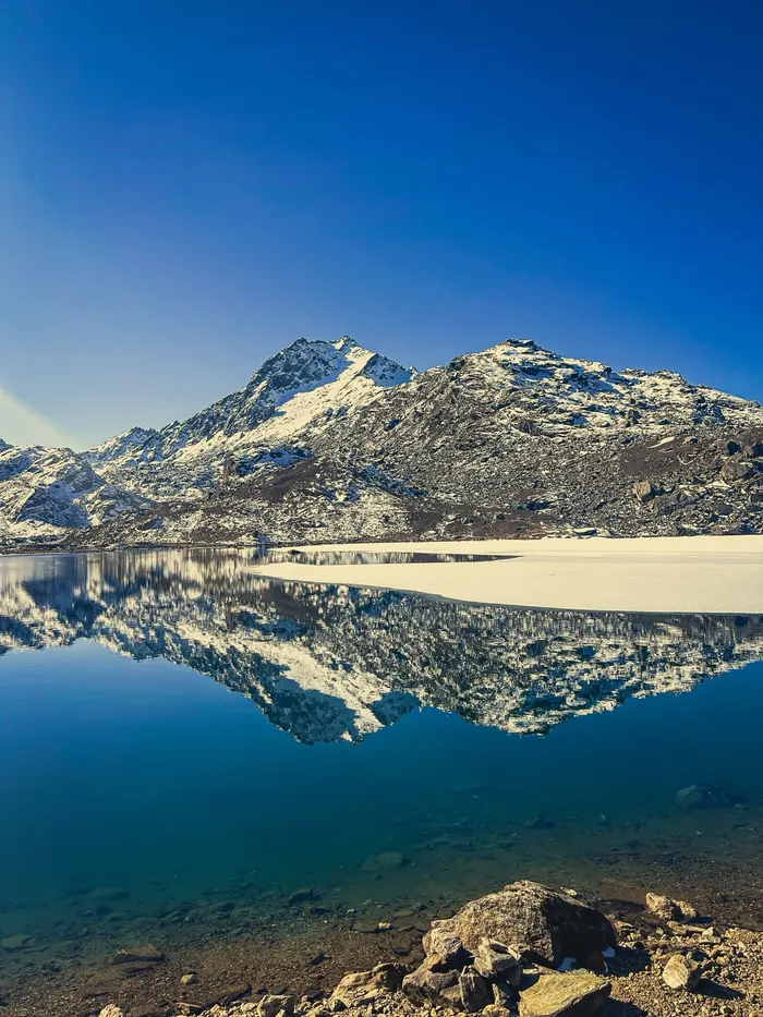
That absence is not a marketing gap waiting to be filled by a first mover. The obstacles are structural: the valley is a day's drive plus a multi day walk from the nearest city, there is no road to most launch prospects, no ambulance or helicopter on standby, and the flying window competes with some of the strongest valley winds in the country. Any responsible operator would have to solve all of that before selling a single seat.

Can You Book a Tandem Flight in Langtang Today?
No. If you search for Langtang paragliding pricing, you will find trekking agencies selling Langtang itineraries, helicopter tours to Gosaikunda, and paragliding companies selling Pokhara flights. What you will not find is a Langtang tandem product, because none exists. Anyone offering one is either reselling a flight in another region or arranging a private expedition on request.
What you can book through Enticing Himalayas is the trekking and pilgrimage side of the same valley. The eight day Langtang Valley Trek and Tserko Ri Summit, the ten day Langtang and Gosaikunda Lake Trek and the five day Gosaikunda Lake Trek all operate inside Langtang National Park with licensed guides, permits and teahouse logistics handled for you. Those itineraries put you on the same ridges a pilot would use, at a fraction of the complexity.
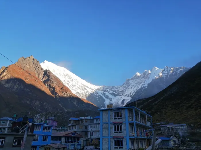
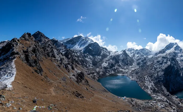
What Makes the Langtang Valley So Attractive to Pilots?
The geography is the draw. Langtang National Park was established in 1976 as Nepal's first Himalayan national park and is the country's fourth protected area, covering 1,710 km2 across the Nuwakot, Rasuwa and Sindhupalchok districts. It contains 26 village communities and the whole of the Langtang valley, and it links in the north and east with the Qomolangma National Nature Preserve in the Tibet Autonomous Region.
The park's highest point is Langtang Lirung at 7,245 m, and the Dorje Lakpa range at 6,988 m bisects the protected area from west to east and then south east. The eastern and western boundaries follow two rivers, the Bhote Koshi and the Trishuli. A valley that is walled by 7,000 m peaks on one side and drained by two major rivers is exactly the shape that produces lift, which is why pilots look at it at all.
Add the cultural layer and the appeal is obvious. The valley is Tamang country. The Tamang are one of Nepal's largest ethnic groups, more than 1.6 million people at the 2021 census, concentrated in the central hills and Himalaya, and Tamang is the fifth most spoken language in the country. Above the villages sit the monasteries, yak pastures and cheese factories of the high valley, and beyond the Lauribina La the trail drops into the Langtang region, home of the Hyolmo people and the sweet apple orchards of the Helambu highlands.

How Does Altitude Reshape Paragliding in Langtang?
A paraglider is a light, foot launched aircraft with no rigid primary structure, and its performance depends entirely on the air it finds. Three mechanisms matter here. A thermal is a rising mass of buoyant air, a convective current created by the sun heating the ground unevenly. An anabatic wind is the warm daytime upslope flow that develops in calm sunny weather, the morning conveyor that carries wings up from a launch. A katabatic wind is the cool, dense downslope flow at night that ends the flying day.
In Langtang those three clocks run against the altitude. Kyanjin Gompa sits at roughly 3,870 m, Tserko Ri at 4,984 m, and the valley floor at Syabrubesi is only about 1,550 m. A wing launched high in the valley is already at the altitude where a Pokhara pilot would be at the top of a very good climb, which means thinner air, faster landings, longer take off runs and much less margin for error. Add ridge lift, the wind deflected upward by a slope large and steep enough to push it up, and the terrain becomes both the opportunity and the hazard.
Cloud tells the story honestly. A cumulus cloud, Latin for heap, has a flat base that marks the condensation level, effectively the day's usable lift ceiling. A line of cumulus, a cumulus street, is a lift highway you can follow for kilometres. Cumulus congestus, the tall vertical version, is the signal that the day has become too strong. In a deep valley ringed by snow peaks, that signal arrives early and should be obeyed immediately. Our guide to Nepal's paragliding geography and thermals explains the same physics for the rest of the country.
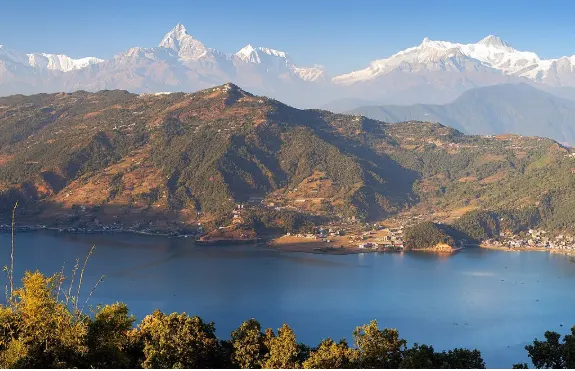
Where Could a Pilot Actually Launch in Langtang?
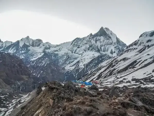
There is no surveyed, permissioned launch in the region, so anything described here is a prospect rather than a facility. The most plausible terrain sits above Kyanjin Gompa, where the valley opens out and slopes rise on both sides toward Tserko Ri and Kyanjin Ri. Further north the valley narrows toward Langshisa Kharka, and across the valley the trekking peak of Yala Peak offers the classic beginner summit for organised expeditions. East and south east of the valley stands Dorje Lakpa, the elegant pyramid visible from the Kathmandu Valley and a landmark for photographers.
Every one of those locations shares the same problems: no vehicle access, no designated landing field, no weather station, and a landing approach that would run across boulder fields, glacial moraine or a fast river. A real expedition would need to walk its wing in, fly it out, and accept that a bad decision means a multi day walk out rather than a short drive to a hospital. That is a completely different sport from a 30 minute tandem above Phewa Lake.

What Permits and Paperwork Would You Need?
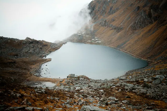
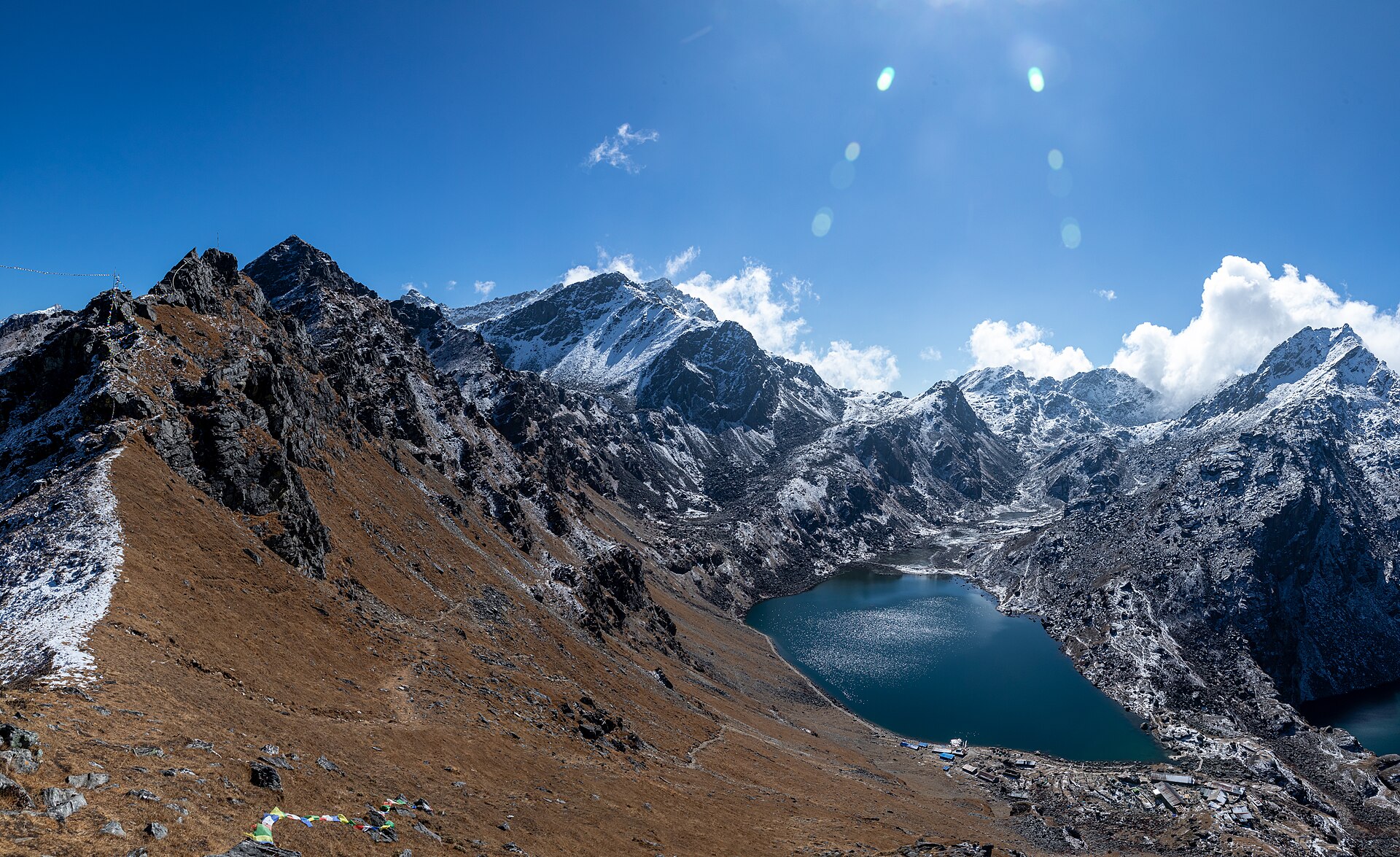
Two layers of permission apply. The first is trekking paperwork: a Langtang National Park entry permit and a TIMS card, both issued in Kathmandu, both required for any route inside the park. Those cover you on foot, including the approach to Gosaikunda Lake and the crossing of the Lauribina La above Gosaikunda at 4,610 m.
The second layer is aviation and mountaineering. In Nepal, climbing permits for the 27 peaks traditionally graded as trekking peaks, which includes Yala Peak, moved from the Nepal Mountaineering Association to the Ministry of Culture, Tourism and Civil Aviation in October 2015, following criticism of transparency in permit issuance. The Nepal Mountaineering Association itself was founded in 1973 and has been a member of the UIAA since 1975. Anything involving a wing in Nepali airspace would also need a licensed pilot, registered equipment, third party and passenger insurance, and coordination with the park office and local authorities.
Practical point: do not assume a Pokhara operator's paperwork travels. Permits are route and region specific, and a park entry permit for a trek is not authorisation to fly. Budget weeks, not days, for the paperwork alone.
How Do You Reach the Langtang Region?
The gateway is the road north from Kathmandu along the Trishuli corridor to Syabrubesi, roughly 1,550 m and the trailhead for every Langtang route. The Trishuli itself is formed where the Gyirong Tsangpo and the Lende Khola meet near Rasuwa Gadhi on the Nepal and Tibet border, and its valley was the traditional trade route between the Kathmandu Valley and Tibet. That history explains the road, the border post and the traffic.
From Syabrubesi the standard walk climbs to Lama Hotel at about 2,380 m, then Langtang village at 3,430 m, then Kyanjin Gompa at about 3,870 m. From Kyanjin you can climb Tserko Ri at 4,984 m for acclimatisation and a full panorama. The alternative exit continues over to Thulo Syabru, Sing Gompa, Gosaikunda and down to Dhunche, which is what our ten day itinerary does.
Access warning for the 2026/27 season: on 26 August 2026 a high velocity flash flood originating in Tibet surged into Rasuwa district, sweeping away homes, destroying sections of highway and severing the Rasuwagadhi border route. Road conditions on this corridor have been under repair since. Check the current situation with your operator before travelling, and read our report on the 2026 Rasuwa flash flood for the background.

When Is the Best Time of Year to Fly in Langtang?
The same two windows that govern trekking govern flying: the post monsoon weeks of October and November, and the pre monsoon spring of March to May. Both bring stable air, clear mornings and settled visibility. Monsoon from June to September brings cloud, rain, landslide risk and wet, unstable slopes. Deep winter is cold, clear and often flyable in theory, but snow, ice and a frozen Gosaikunda, which stays frozen for around six months of the year, make the valley a genuinely serious place.
| Season | Flying outlook | Notes |
|---|---|---|
| October to November | Best window | Clear post monsoon air, stable mornings, peak trekking crowds |
| December to February | Cold and technical | Snow line low, frozen lakes, short days, minimal margin |
| March to May | Strong spring window | Rhododendron in bloom, building afternoon thermals, haze later |
| June to September | Avoid | Monsoon cloud, rain, landslides and unstable slopes |
If you want the valley at its most photogenic, time a trek to the spring rhododendron and the Janai Purnima festival at Gosaikunda, when pilgrims gather at the sacred lake in the same park. Our Gosaikunda pilgrimage guide covers the festival timing.
How Much Would a Langtang Paragliding Expedition Cost?
There is no retail price because there is no product. A private expedition would be quoted case by case and would have to absorb pilot fees, wing transport by porter, park permits, insurance, communications equipment and a support crew. For scale, here is what flying costs at Nepal's established sites, drawn from our own published guides.
| Site | Typical tandem price | Source |
|---|---|---|
| Pokhara, 20 to 30 minute flight | NPR 8,500 to 12,000 | Pokhara destination guide |
| Pokhara cross country, 45 to 60 minutes | NPR 12,000 to 15,000 | Pokhara destination guide |
| Kathmandu Valley launches | USD 70 to 140 | Kathmandu paragliding guide |
| Kushma, Parbat | NPR 6,000 to 10,000 | Kushma paragliding guide |
| Photo and video package | USD 15 to 25 | Nepal paragliding overview |
| Langtang region | No fixed price, expedition quoted | No commercial operator exists |
Read those numbers as a reality check on effort, not as a discount. A Langtang expedition would cost multiples of a Pokhara tandem because you are paying for a team to walk equipment into a national park and manage risk with no infrastructure. Our Langtang Valley trek cost guide breaks down what a normal Langtang trek costs, which is the honest comparison if budget is your deciding factor.
Is Paragliding in the Langtang Region Dangerous?
Yes, relative to commercial tandem flying, and the honest reasons are altitude, terrain and remoteness. Launching at 3,900 m or higher reduces wing performance and increases the speed of everything, including mistakes. The valley funnels strong winds, and a pilot who misjudges the afternoon cycle can be pushed toward rock faces with no bailout field. There is no road under most of the flight lines, no rapid rescue, and no mobile coverage in many side valleys.
The region also carries a recent memory of geological violence. The 25 April 2015 earthquake, magnitude 7.8 to 7.9, killed 8,962 people across Nepal, India, China and Bangladesh and triggered a huge avalanche in the Langtang valley, where 250 people were reported missing. Slopes that slid once can slide again, and the August 2026 flood in Rasuwa showed how quickly this terrain can rewrite itself. Any expedition plan should treat slope stability, weather windows and evacuation options as primary subjects, not footnotes.
What Are the Alternatives if Langtang Does Not Work?
The sensible plan is to split the trip. Trek the Langtang valley or the Gosaikunda pilgrimage on foot, then fly somewhere the sport is established. That combination gives you the Himalayan scenery and the aerial photographs without asking a single pilot to invent a new flying site. Enticing Himalayas runs both halves: see the Langtang Valley trek and the paragliding in Nepal activity page.
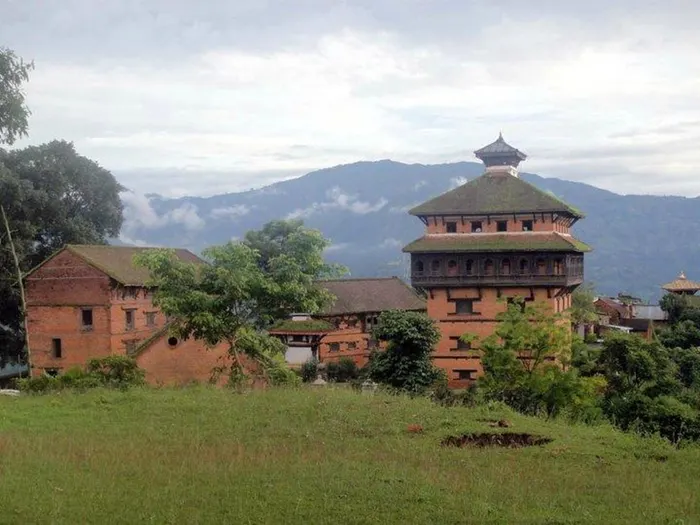
If you want the closest thing to flying over a sacred Himalayan lake without a wing, the Gosaikunda helicopter tour flies you over Gosaikunda instead. If you want a genuinely different adventure sport on the same road north, the Nuwakot heritage and hills tour is a fixture of the Rasuwa calendar. And if your heart is set on a real tandem, the Top 10 paragliding sites in Nepal guide ranks the sites worth your time.

How Does Langtang Compare With Nepal's Tandem Sites?
Laid out side by side, the difference is infrastructure rather than scenery. Langtang wins on landscape and loses on every operational measure a paying passenger should care about.
| Destination | Commercial tandem | Access | Best for |
|---|---|---|---|
| Pokhara and Sarangkot | Yes, year round | Road and flights | First tandem, lake and mountain views |
| Kathmandu Valley | Yes, seasonal | In the city | Short trips and layovers |
| Bandipur | Yes, on request | Half day drive | Quiet hill town, fewer crowds |
| Kushma | Yes, adventure hub | Drive from Pokhara | High adrenaline, bungee combination |
| Langtang | No | Drive plus multi day trek | Trekking, culture and pilgrimage |
What Should You Pack for a Langtang Flying Expedition?
If you are trekking, pack for a Himalayan teahouse trek in the same park as Gosaikunda: layered insulation, a windproof shell, broken in boots, water purification, a headlamp and cash, because there is no ATM above the road head. If you are seriously considering a private flying expedition, the list grows to include:
- A wing suited to high altitude launch and a spare reserve, both shipped in and inspected before departure
- Pilot certification, logbook, medical and insurance documents in hard copy
- Satellite communicator or personal locator beacon, plus a written evacuation plan filed with your team
- Altitude medication, a pulse oximeter and a conservative acclimatisation schedule
- Expedition grade cold weather gear for launch at 4,000 m and above
- Porters or yaks arranged in advance for equipment, with weights within legal limits
- Langtang National Park permits, TIMS cards and any peak or aviation approval obtained before arrival
Notice how much of that list is paperwork and safety equipment rather than flying gear. That ratio is the real story of Langtang paragliding.
What Is the Honest Verdict?
Langtang is not a paragliding destination, and pretending otherwise would set you up for an expensive disappointment. It is one of the great trekking valleys of the Himalaya, an hour and a half of mountains stacked above a Tamang valley, with a sacred lake at the head of the trail and a national park that has protected this landscape since 1976. Come for that.
Then plan your flight properly, in Pokhara or the ridges around it or the Annapurna region, where certified pilots, insured aircraft, designated landing fields and rescue cover already exist. Book a real Langtang trek through our Nepal trekking packages collection, and if you want to understand the wider flying landscape before you commit, start with the complete 2026 paragliding in Nepal guide. That is the itinerary that gives you both the valley and the wing, without asking anyone to pretend a frontier is a product.
Related Reading From the Paragliding Series
- Paragliding in Nepal: the complete 2026 guide
- Top 10 paragliding sites in Nepal, ranked
- Paragliding in the Everest region: is it possible?
- Paragliding in the Annapurna region: a bird's eye view
- The geography of Nepal's paragliding sites and why thermals matter
- Paragliding in Nepal's Far West: emerging sites
- Chandragiri paragliding: the Kathmandu Valley's closest launch
- Langtang region guide 2026/27
- Langtang Valley trek itinerary: 7 day guide
- Nuwakot heritage and hills tour
Frequently Asked Questions
Is there paragliding in the Langtang region?
There is no commercial paragliding in the Langtang region. No operator sells tandem flights from Syabrubesi, Langtang village, Kyanjin Gompa or Dhunche, and there is no published price. Nepal's tandem industry operates in Pokhara, the Kathmandu Valley, Bandipur and Kushma, all of which have road access, permanent pilots and rescue cover.
Can tourists book a tandem flight in Langtang?
No. Langtang National Park is a trekking and pilgrimage destination, not a flying destination, so there is nothing for a visitor to book. If you want a guaranteed tandem, book one in Pokhara, Kathmandu, Bandipur or Kushma. If you want the Langtang landscape, book a guided trek through the valley instead.
Where are the possible launch points in the Langtang valley?
The most plausible high launch terrain sits above Kyanjin Gompa, on the slopes rising toward Tserko Ri at 4,984 m and Kyanjin Ri. Yala Peak offers the classic trekking summit nearby. None of these is a surveyed or permissioned launch site, and all lack vehicle access, landing fields and weather reporting.
How much would a private paragliding expedition in Langtang cost?
There is no retail price, so any expedition would be quoted individually and would include pilot fees, permits, insurance, communications and porter support. For reference, a Pokhara tandem costs NPR 8,500 to 12,000, Kathmandu Valley flights run USD 70 to 140, and Kushma tandem flights cost NPR 6,000 to 10,000.
What is the best time of year for flying in the Langtang region?
The two stable windows are October to November after the monsoon and March to May in spring. Both bring clear mornings and settled air. June to September is monsoon season with cloud, rain and landslide risk. December to February is cold, snowy and technical, and Gosaikunda stays frozen for around six months.
Why is there no commercial tandem paragliding in Langtang?
Because the operating conditions are absent. Langtang is a day's drive plus a multi day walk from Kathmandu, has no road to most launch prospects, no designated landing fields, no rapid rescue or helicopter cover, and strong valley winds. Those gaps would need to close before any responsible operator could sell passenger tandem flights there.