Introduction to the Forbidden Kingdom
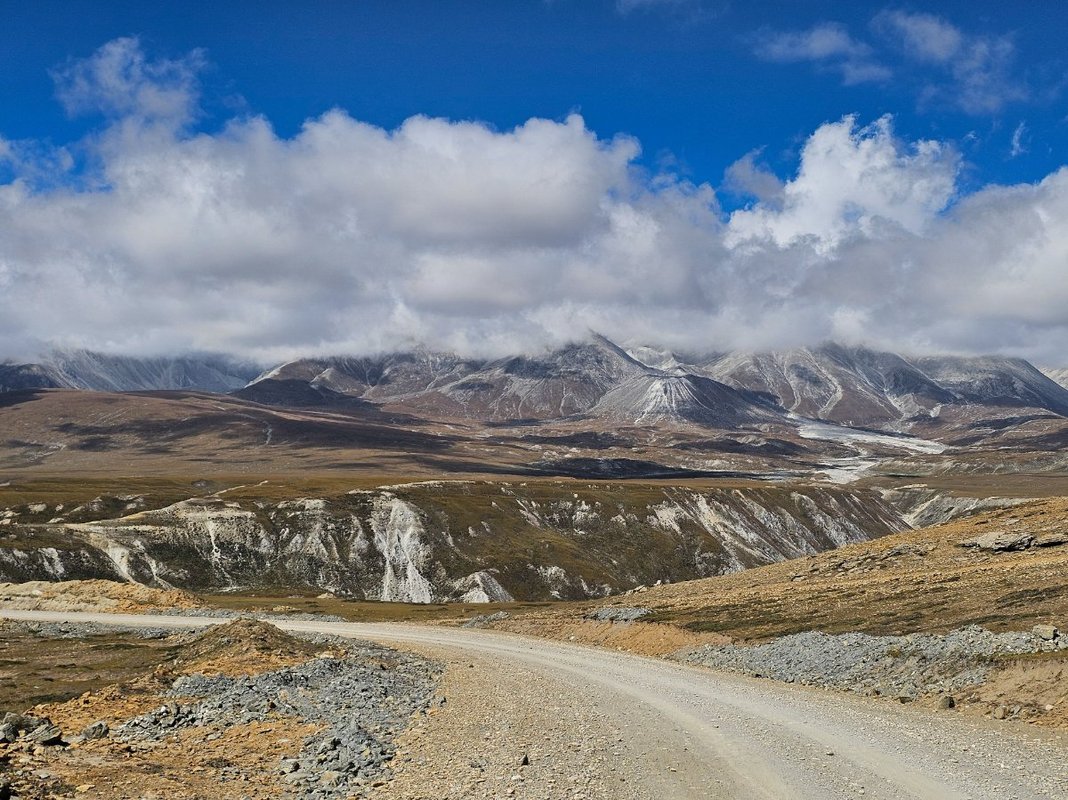
Upper Mustang is one of the most extraordinary trekking destinations on the planet. Tucked away in the rain shadow of the Annapurna and Dhaulagiri massifs, this former Buddhist kingdom remained closed to outsiders until 1992. Even today, access is tightly controlled through a restricted area permit that limits visitor numbers and preserves the fragile cultural and ecological landscape. The region feels like a different country, and in many ways it is. The people here still speak Tibetan, practice an unbroken form of Vajrayana Buddhism, and live in villages that have changed little over centuries. For trekkers willing to make the journey, Upper Mustang offers a rare combination of high desert scenery, ancient cave complexes, royal palaces, and monasteries that predate many of the better known landmarks in the Khumbu and Annapurna regions.
This guide covers everything you need to plan a trek to Upper Mustang in 2026: the route from Jomsom to Lo Manthang, permit requirements and costs, the landscape and geology, the ancient cave systems, the royal palace and monasteries of Lo Manthang, a day by day itinerary summary, the best time to go, total costs, and a packing list. Whether you are a seasoned trekker looking for something beyond the standard routes or a cultural traveller drawn to the Tibetan Buddhist world, Upper Mustang delivers an experience that no other trek in Nepal can match.
Route Overview: Jomsom to Lo Manthang
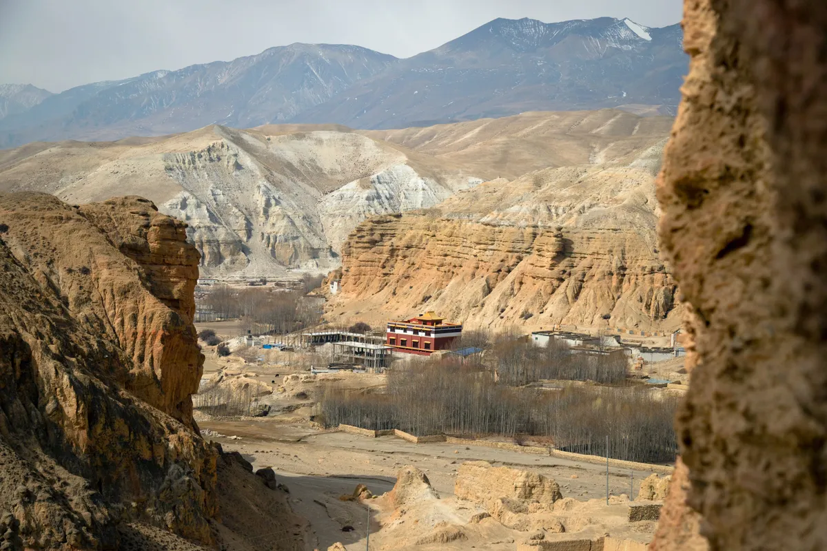
The standard Upper Mustang trek begins at Jomsom, the administrative centre of the Mustang district. Jomsom sits at 2,743 metres along the Kali Gandaki river, the deepest gorge in the world. Most trekkers fly from Pokhara to Jomsom on a short but spectacular morning flight that threads between Annapurna I and Dhaulagiri. The alternative is to trek from Nayapul through the Kali Gandaki gorge, which adds several days but gives you a more gradual acclimatisation profile.
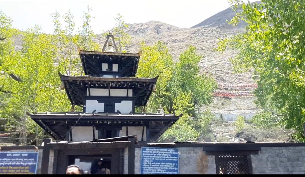
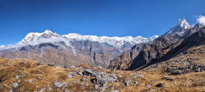
From Jomsom the trail heads north through Kagbeni, the gateway to Upper Mustang. Kagbeni is a medieval village of narrow alleys, flat roofed mud brick houses, and a 16th century monastery perched above the river. Crossing north of Kagbeni, you officially enter the restricted area and the landscape changes dramatically. The green terraces of lower Mustang give way to a barren, wind sculpted desert of red and ochre rock, deep canyons, and wide gravel plains.
The trail follows the Kali Gandaki for the first section, then climbs eastward through a series of villages including Chele, Samar, and Ghiling. You cross several passes, the most notable being the Chungsi Cave detour and the Nyi La at 4,010 metres. The route passes through distinct geological zones where the rock colour shifts from deep red to grey to pale yellow. After Ghiling the trail continues to Tsarang, a village dominated by an old fort and monastery, before making the final approach to Lo Manthang, the walled capital of the former kingdom, at 3,840 metres.
The full trek from Jomsom to Lo Manthang and back typically takes 14 to 16 days. Many itineraries include a side trip to the spectacular Kali Gandaki gorge and the Chungsi Cave. The return journey can follow the same trail back or use an alternative route via the Chho La pass and the village of Dhi, which adds variety and avoids retracing your steps entirely. A jeep return from Lo Manthang to Jomsom is also possible and can save several days for trekkers with limited time.
The Restricted Area Permit: $500 for 10 Days
Upper Mustang is a restricted area under Nepali immigration law. Foreign trekkers must obtain a Restricted Area Permit (RAP) from the Department of Immigration in Kathmandu, and the permit is expensive. As of 2026, the fee is USD $500 per person for the first 10 days, and USD $50 per person per day thereafter. This is in addition to the Annapurna Conservation Area Permit (ACAP) which costs approximately NPR 3,000 per person.
The permit must be arranged through a registered trekking agency. Independent trekking is not permitted in Upper Mustang. Your agency will handle the paperwork, which requires a copy of your passport, passport size photographs, and the full fee in advance. The permit is checked at police and army checkpoints in Kagbeni and again at the entrance to Lo Manthang. You must carry the permit with you at all times during the trek.
The high permit fee serves several purposes. It limits the number of visitors to roughly 1,000 per year, which keeps the region pristine and culturally intact. It also generates revenue that funds local infrastructure and conservation projects. While $500 is a significant cost, most trekkers who have been to Upper Mustang consider it worth every penny. The experience is genuinely unique, and the limited access is precisely what preserves it.
A minimum of two trekkers is required for the restricted area permit. Solo trekkers cannot obtain the permit independently. If you are travelling alone, your agency can help pair you with another trekker or arrange for a guide to accompany you as the second member. Plan ahead: the permit processing takes at least one working day in Kathmandu, and you should have all documents ready before you arrive in Nepal if possible.
Landscape: The Rain Shadow Desert
The defining characteristic of Upper Mustang is its rain shadow climate. The Annapurna and Dhaulagiri massifs, both exceeding 8,000 metres, block the monsoon clouds rolling in from the south. While the rest of Nepal receives heavy rainfall from June to September, Upper Mustang receives less than 200 millimetres of precipitation annually. The result is a high altitude desert that looks more like the Tibetan Plateau than the typical image of Nepal.
The landscape is a geologist's dream. The entire region sits on sedimentary rock formations that were once the bed of an ancient sea, the Tethys Ocean, which existed before the Indian plate collided with the Eurasian plate and pushed up the Himalaya. Over millions of years, wind and water erosion have carved these formations into fantastical shapes: towering hoodoos, deep slot canyons, striated cliffs of red, orange, yellow, and grey, and vast expanses of rounded hills that resemble the surface of Mars.
Tree cover is almost nonexistent above Kagbeni. The vegetation consists of low scrub, thorny bushes, and hardy grasses. Willows and poplars grow only in the irrigated villages where snowmelt is channelled through ancient irrigation systems. The contrast between the barren, mineral coloured hillsides and the bright green fields of barley and buckwheat around the villages is one of the most striking visual features of the trek.
Wind is a constant presence in Upper Mustang, particularly in the afternoons. The funnel effect of the Kali Gandaki gorge can produce strong gusts that carry dust and sand. Trekkers should carry a buff or scarf to cover the face and protect cameras and electronics from dust. Despite the harsh appearance, the region supports a surprising diversity of wildlife including blue sheep, marmots, snow leopards, and several species of raptor including the Himalayan griffon and lammergeier.
Ancient Cave Systems of Upper Mustang
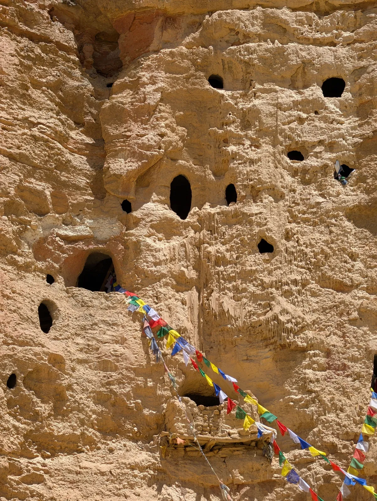
One of the most fascinating and mysterious features of Upper Mustang is its network of ancient cave systems. Thousands of caves have been carved into the cliff faces across the region, some perched hundreds of metres above the valley floor. These caves are believed to date back between 1,000 and 3,000 years, though precise dating remains a challenge. Archaeologists and explorers have only begun to study them systematically in recent decades.
The caves serve multiple purposes depending on their location and construction. Some were used as dwellings, with multiple rooms connected by narrow tunnels and ladders. Others functioned as burial chambers, with human remains and artefacts discovered inside. Still others were used as meditation retreats by Buddhist monks, and some served as defensive positions during periods of conflict, offering vantage points from which inhabitants could monitor approaching threats.
The most famous cave complex accessible to trekkers is the Chungsi Cave, located near the village of Chele. This cave is associated with Padmasambhava, the eighth century tantric master who brought Buddhism to Tibet and the Himalayan region. A small shrine inside the cave is still used for worship today. The climb to the cave involves a steep ascent of roughly 300 metres, but the views from the entrance are extraordinary.
Another remarkable site is the cave complex near the village of Lo Gekar, also known as Garphu. Here, caves are carved into a massive cliff face at several levels, connected by exposed wooden ladders and narrow ledges. Some of these caves contain murals and religious objects, though many have been damaged by weather and looting over the centuries.
In 2009, a team of archaeologists led by the US based Sky Caves Foundation discovered human remains in a cave complex near Samdzong that dated back approximately 2,000 years. The remains were found alongside copper beads, iron objects, and bamboo artefacts, suggesting long distance trade networks even in ancient times. These discoveries have reshaped the understanding of prehistoric occupation in the Himalaya and confirm that Upper Mustang has been a corridor of human movement and cultural exchange for millennia.
Trekkers should note that many caves are not accessible or are culturally sensitive. Always ask your guide before entering a cave, and never touch murals or religious objects. Photography may be prohibited inside some caves, particularly those that contain active shrines. Respecting these sites is essential to their preservation.
Lo Manthang: Palace and Monasteries
Lo Manthang is the heart and soul of Upper Mustang. Founded in 1380 by Ame Pal, the first king of Lo, it served as the capital of the Kingdom of Lo for over 600 years. The walled city sits on a plateau at 3,840 metres, enclosed by a six metre high wall of mud brick that forms an irregular rectangle roughly 200 by 250 metres. Four gateways face the cardinal directions, though only two are in regular use today. Inside the walls, narrow alleys wind between closely packed houses, mani walls, and chortens, creating an atmosphere that feels frozen in time.
The most prominent structure in Lo Manthang is the four storey royal palace, a whitewashed building that dominates the city skyline. The palace was the residence of the last officially recognised king, Jigme Dorje Palbar Bista, who passed away in 2016. While the monarchy was formally abolished when Nepal became a republic in 2008, the palace remains a powerful symbol of Lo's heritage. Parts of the palace have been restored in recent years with support from international heritage organisations, and some rooms can be visited with permission.
Within and around Lo Manthang are several important monasteries that rank among the most significant Tibetan Buddhist sites in Nepal. The three main monasteries inside the city walls are Jampa Lhakhang, Thubchen Gompa, and Chodey Gompa. Jampa Lhakhang, also known as the Temple of Maitreya, was built in the early 15th century and contains an enormous clay statue of the future Buddha Maitreya that rises through three floors. The walls are covered with ancient murals of remarkable artistry, some of which have been restored by the American Himalaya Foundation in collaboration with local monks.
Thubchen Gompa is a massive assembly hall with columns of carved wood and murals depicting Buddhist deities and historical scenes. The scale and quality of the artwork here rival anything found in the better known monasteries of Tibet. Restoration work between 2001 and 2010 stabilised the structure and preserved the murals, which had been deteriorating due to water damage and centuries of candle soot.
Chodey Gompa is the active monastic school of Lo Manthang, where young monks study Buddhist philosophy, ritual, and scripture. Visiting during a prayer ceremony is a profound experience, with the sound of chanting, drums, and horns filling the dimly lit hall and the smell of juniper incense hanging in the air.
Just outside the city walls, the village of Chhosar offers more cave monasteries and the Nyphu Cave Monastery, an active retreat site carved directly into the cliff. A short drive or walk from Lo Manthang brings you to the village of Garphu and the revered Guru Rinpoche cave, another important pilgrimage site. Most itineraries include at least one full rest day in Lo Manthang to explore these sites, and many trekkers consider it the highlight of the entire journey.
Day by Day Trek Summary
Below is a standard 14 day itinerary for the Upper Mustang trek. Distances and timings are approximate and can vary based on weather, trail conditions, and your own pace.
Day 1: Pokhara to Jomsom. A 20 minute morning flight from Pokhara to Jomsom (2,743 m). Spend the afternoon acclimatising and preparing permits for the checkpoint tomorrow.
Day 2: Jomsom to Kagbeni. A gentle walk of approximately 3 hours north along the Kali Gandaki river to Kagbeni (2,804 m). This is the last village before the restricted area begins. Visit the 16th century monastery and explore the medieval streets.
Day 3: Kagbeni to Chele. The trail climbs gradually through the restricted area checkpoint. Cross the river several times and ascend to the village of Tangbe before reaching Chele (3,050 m) after roughly 6 hours of walking.
Day 4: Chele to Samar via Chungsi Cave. An optional detour to the Chungsi Cave adds about 2 hours to the day. The trail then climbs to a small pass before descending to Samar (3,660 m), a pleasant village in a grove of poplar trees. Approximately 6 to 7 hours.
Day 5: Samar to Ghiling. Cross the Bhena La (3,860 m) and the Chung La (3,810 m) passes. The trail traverses dramatic red rock formations before descending to Ghiling (3,570 m), home to a small monastery and chorten. Approximately 5 hours.
Day 6: Ghiling to Tsarang. A moderate day crossing the Nyi La (4,010 m), the highest point on the standard route. Descend through a landscape of eroded cliffs to the large village of Tsarang (3,560 m), which has an impressive old fort, monastery, and a collection of ancient religious artefacts. Approximately 5 to 6 hours.
Day 7: Tsarang to Lo Manthang. The final approach to the capital. Cross the Charang La (3,870 m) and then descend into the wide plateau where Lo Manthang (3,840 m) appears on the horizon, its white walls gleaming against the barren landscape. Approximately 4 to 5 hours.
Day 8: Lo Manthang exploration. A full rest day to explore the walled city. Visit the royal palace, Jampa Lhakhang, Thubchen Gompa, and Chodey Gompa. Walk the alleys, meet local people, and absorb the atmosphere of this remarkable place.
Day 9: Lo Manthang to Chhosar and back. A day trip to the nearby village of Chhosar to visit the Nyphu Cave Monastery and other cave sites. Return to Lo Manthang in the afternoon. Approximately 4 to 5 hours total.
Day 10: Lo Manthang to Tsarang. Begin the return journey, retracing the trail back over the Charang La to Tsarang. Approximately 4 hours.
Day 11: Tsarang to Ghiling. Cross back over the Nyi La and descend to Ghiling. Approximately 5 hours.
Day 12: Ghiling to Chhuksang. Continue south, passing through Samar and Chele to reach Chhuksang (3,020 m) at the confluence of two rivers. Approximately 6 to 7 hours.
Day 13: Chhuksang to Jomsom. The final trekking day. Walk south through Kagbeni and along the Kali Gandaki to Jomsom. Approximately 5 to 6 hours.
Day 14: Jomsom to Pokhara. A morning flight back to Pokhara, weather permitting. Alternatively, take a ground transport option via Beni, which takes a full day by jeep.
Best Time to Go: Monsoon Is Actually Best
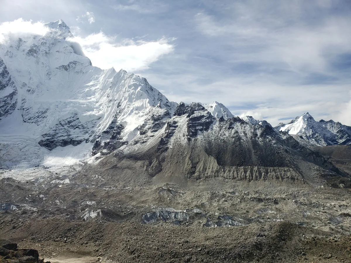
This is one of the most counterintuitive aspects of planning an Upper Mustang trek. While almost every other trek in Nepal is best avoided during the monsoon months of June through September, Upper Mustang is the exact opposite. Because the region sits in the rain shadow of the Annapurna and Dhaulagiri, it receives almost no monsoon rain. The skies are clear, the temperatures are warm during the day, and the agricultural fields around the villages are green and vibrant with growing barley and buckwheat. This is the most beautiful time of year to visit.
The summer months also coincide with several important festivals. The Tiji Festival, a three day ritual dance ceremony held in Lo Manthang, usually takes place in May or June. It commemorates the victory of a deity over a demon that plagued the kingdom. Monks in elaborate costumes perform ritual dances in the courtyard of the royal palace, and the entire community gathers to witness the spectacle. This is one of the most powerful cultural events in the Himalayan world and a major draw for trekkers who time their visit to coincide with it.
The shoulder seasons of late April to early June and late September to October are also excellent. Autumn brings cooler nights and crystal clear visibility after the monsoon has cleared the atmosphere, though by October the fields have been harvested and the landscape is drier. Spring offers warming temperatures and the first green shoots in the fields, though mornings can still be cold.
Winter from November to March is not recommended for trekking. Daytime temperatures can be manageable, but nighttime temperatures regularly drop below minus 15 degrees Celsius, and snow can block the high passes. Many lodges and tea houses close for the season, and the villages are largely deserted. If you must travel outside the main season, late April is the earliest practical window.
For most trekkers, the optimal window is mid May through late September. This aligns with the monsoon in the rest of Nepal but is the driest and greenest time in Upper Mustang. The only downside is that the afternoon winds can be strong, particularly in the Kali Gandaki gorge. Start your walking early in the morning to avoid the worst of the wind.
Costs: What to Budget for Upper Mustang
Upper Mustang is one of the more expensive treks in Nepal, primarily because of the restricted area permit and the requirement to trek with a registered agency. Here is a breakdown of the typical costs for a 14 day trek in 2026.
Restricted Area Permit: USD $500 per person for the first 10 days, plus $50 per day after that. For a 14 day trek, the permit alone costs $700 per person.
Annapurna Conservation Area Permit (ACAP): Approximately NPR 3,000 per person (about USD $22).
Trekking agency package: Most agencies charge between USD $1,800 and $2,800 per person for a full guided package including guide, assistant guide, porters, accommodation, meals, and transportation to and from Jomsom. The cost varies based on group size, service level, and whether you choose lodge based trekking or a fully supported camping trek.
Flights: The round trip flight between Pokhara and Jomsom costs approximately USD $150 to $200 per person, depending on the season and availability.
Accommodation in Kathmandu and Pokhara: Budget another USD $100 to $200 for hotel nights before and after the trek, depending on your standard.
Visa for Nepal: USD $30 for 15 days or $50 for 30 days on arrival for most nationalities.
Miscellaneous: Budget USD $100 to $150 for hot showers, battery charging, Wi-Fi at lodges, drinks, and tips for your trekking crew.
Taking all of this into account, a realistic total budget for a standard 14 day Upper Mustang trek ranges from USD $2,700 to $3,800 per person. While this is significantly more than a standard Annapurna or Everest trek, the permit fee and the restricted access are what preserve the region's unique character. You are paying for an experience that very few people in the world have had.
Packing List for Upper Mustang
Packing for Upper Mustang requires preparation for a high altitude desert environment with significant temperature swings. Daytime temperatures in summer can reach 20 to 25 degrees Celsius, while nighttime temperatures at altitude can drop to near freezing even in July. Wind and dust are constant factors. Here is a comprehensive packing list.
Clothing: A layering system is essential. Bring a moisture wicking base layer, a warm mid layer such as a fleece or light down jacket, and a windproof and waterproof outer shell. Even though rain is rare, a shell jacket protects against wind and dust. Bring two to three trekking shirts, one pair of trekking trousers and one pair of comfortable camp trousers, a warm hat, a sun hat with a wide brim, and a buff or scarf to cover your face from dust. Lightweight gloves are useful for early morning starts. Pack at least four pairs of trekking socks and a pair of light camp shoes or sandals for evenings.
Footwear: Sturdy, broken in trekking boots with good ankle support are essential. The trails are rocky and uneven in many sections. Make sure your boots are well worn before the trek to avoid blisters.
Sleep gear: Most lodges provide blankets, but a three season sleeping bag rated to minus 5 degrees Celsius is recommended for comfort and hygiene. A sleeping bag liner adds warmth and can be washed more easily than the bag itself. An inflatable sleeping pad is optional but improves comfort on hard lodge beds.
Backpack: A 40 to 50 litre daypack if you are using a porter, or a 60 to 65 litre pack if you are carrying your own gear. A rain cover is essential even in the rain shadow, as it doubles as a dust cover.
Health and first aid: Bring a personal first aid kit with blister treatment, pain relievers, antiseptic, bandages, and any personal medications. Diamox (acetazolamide) for altitude sickness prevention is recommended by many trekking doctors. Water purification tablets or a filter bottle are essential, as bottled water is not available in most villages and boiling water is the alternative. Lip balm with SPF, sunscreen (SPF 50+), and moisturiser are critical in the dry, windy environment.
Electronics: A headlamp with spare batteries, a power bank (10,000 mAh or larger), and a universal adapter. Solar chargers are popular on this trek since sunlight is abundant. A camera with a zoom lens is ideal for the landscape and architectural detail. Protect all electronics in sealed bags against dust. A buff or cloth over the camera when not in use helps prevent dust infiltration.
Documents: Passport with at least six months validity, Nepal visa, printed copies of your restricted area permit and ACAP, travel insurance that covers high altitude trekking up to 4,500 metres, and a small amount of cash in NPR for incidentals. There are no ATMs or card payment facilities in Upper Mustang.
Miscellaneous: A refillable water bottle or hydration bladder, a pack towel, a knife or multi tool, a small notebook and pen, and a book or e reader for the long evenings. Trekking poles are highly recommended for the descents and for stability on rocky sections. Binoculars are a wonderful addition for spotting wildlife and examining distant cave systems.
Final Thoughts on Trekking Upper Mustang in 2026
Upper Mustang is not a typical trekking destination, and that is precisely its value. The restricted area permit and the requirement to travel with a registered agency mean that you will not encounter the crowds found on the Everest Base Camp trail or the Annapurna Circuit. The landscape is unlike anything else in Nepal, a high altitude desert of impossible colours and forms carved by wind and water over geological time. The ancient cave systems offer a window into a past that is still being uncovered by archaeologists. Lo Manthang, with its royal palace and monasteries, is one of the most atmospheric settlements in the entire Himalayan region.
For 2026, the region remains as compelling as ever. Restoration work on the monasteries continues, local infrastructure is slowly improving, and awareness of the region is growing among discerning travellers. If you are considering this trek, plan ahead: arrange your permit and agency several months in advance, time your visit for the monsoon months if possible, and prepare for a journey that will challenge your legs and expand your understanding of the Himalayan world. Upper Mustang is a place that stays with you long after you have returned home, and for those who make the effort to reach it, the rewards are immeasurable.