The Geography of Nepal's Paragliding Sites: Why Thermals Matter

Understanding Nepal paragliding geography is the single best way to understand why this small country has become one of the world's great free-flight destinations. Nepal stacks an extraordinary range of landscapes into a compact area: the grassy plains of the Terai, the fossil-bearing Churia (Sivalik) hills of the outer Himalaya, the Mahabharat ridges that average 3,700 to 4,500 metres, and finally the Great Himalaya, a chain that contains more than 100 peaks above 7,200 metres. For a paraglider pilot, that stacked terrain is a machine for making weather. Sunlit valley floors heat up, ridges catch wind, and huge columns of rising air called thermals switch on almost every clear day. This guide explains how that geography works, region by region, and why thermals are the invisible engine behind almost every memorable flight you can book in Nepal.
Quick answer: Nepal's paragliding geography works because warm valley air rises against cold high ridges. The Pokhara Valley, with Phewa Lake at 742 metres and the Sarangkot launch ridge at 1,592 metres, produces smooth, reliable thermals that carry tandem flights over the lake almost daily in season. The same sun-and-slope physics, scaled differently, shapes flying from the Kathmandu Valley to the Kali Gandaki gorge.
What Makes Nepal's Paragliding Geography So Special?
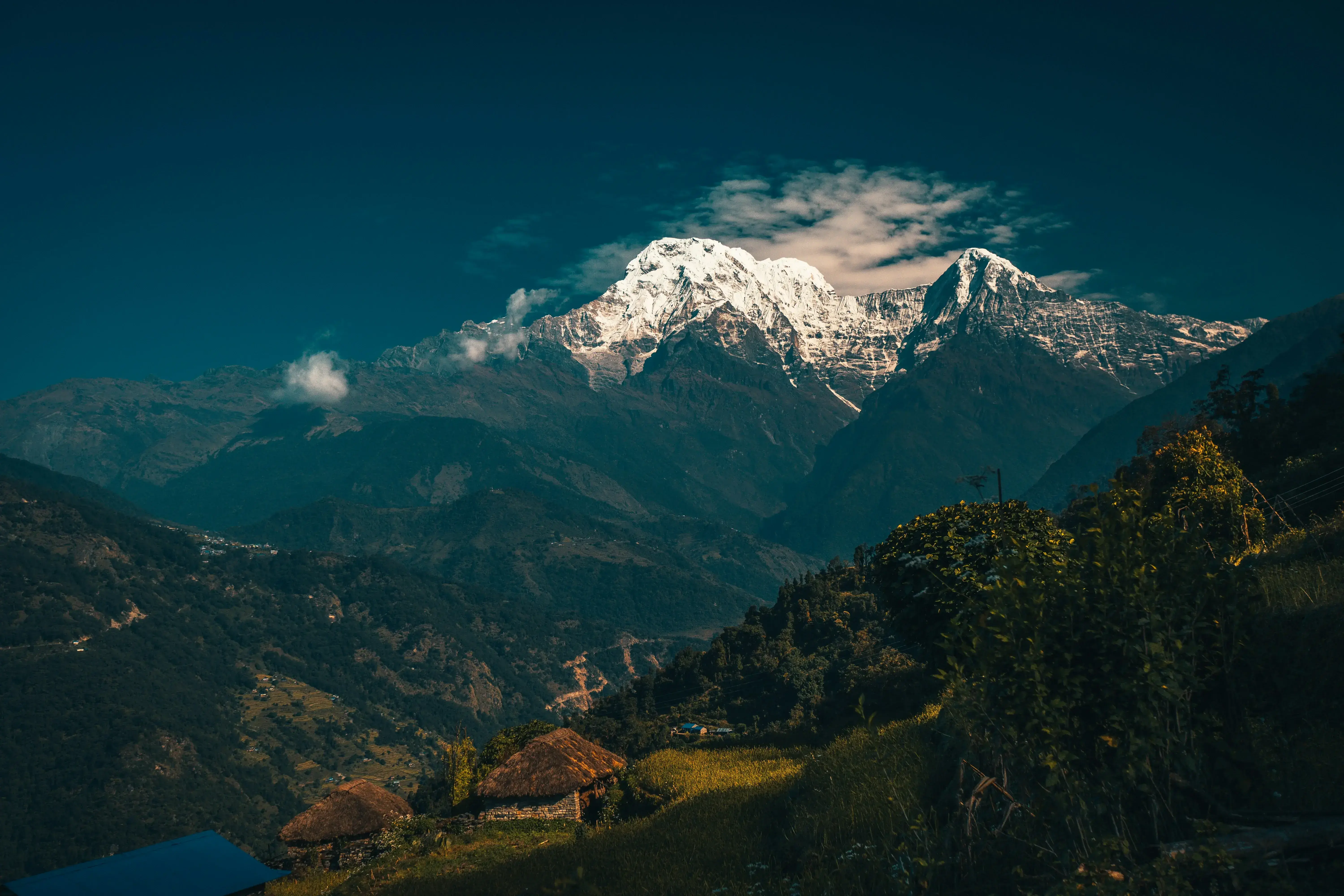
Most countries offer one or two kinds of flying terrain. Nepal offers a complete staircase of it. In the south, the Terai plains and the low Churia hills warm quickly under the sun. In the middle, the Mahabharat Range, also called the Lower Himalayan or Lesser Himalayan Range, runs east to west with an average elevation of 3,700 to 4,500 metres, sitting between the Sivalik Hills to the south and the Great Himalayas to the north. In the north, the high Himalaya rises abruptly: Annapurna I at 8,091 metres is the tenth highest mountain on Earth, and Dhaulagiri at 8,167 metres is the seventh highest and the highest mountain lying entirely within one country's borders.
The Annapurna Conservation Area shows just how tightly this elevation is packed. Nepal's largest protected area covers 7,629 square kilometres and ranges from 790 metres at its lowest point to the 8,091 metre summit of Annapurna I, spanning the districts of Manang, Mustang, Kaski, Myagdi and Lamjung. When a valley floor sits at subtropical temperatures and a snow line sits within sight of it, the temperature differences that drive thermals are dramatic and dependable. That is the core of Nepal paragliding geography: relief energy, the vertical distance between warm ground and cold ridge, on a scale few flying regions can match. Explore the full range of Annapurna Region landscapes to see the terrain pilots fly beside.
What Exactly Is a Thermal, and Why Do Paraglider Pilots Chase Them?
A thermal is a rising mass of buoyant air, a convective current in the atmosphere that transfers heat energy vertically. Thermals are created by the uneven heating of the Earth's surface by the sun: a dark ploughed field, a rocky slope or a sun-baked hillside warms faster than a lake, a forest or a shaded valley, and the air above that warm patch expands, becomes lighter than the air around it, and lifts off the ground. When enough of this air rises in one place, it forms an invisible column that can climb thousands of metres.
For a paraglider, thermals are fuel. A glider has no engine, so every metre of altitude comes either from the launch hill or from rising air. A pilot who circles inside a thermal gains height the way a hawk does, and then spends that height gliding to the next thermal, walking a staircase across the sky. This is why experienced pilots talk about "reading" the ground: they look for the sunniest slopes, the sharpest ridgelines and the cloud markers that betray where lift is working. Nepal's terrain happens to be exceptionally easy to read, which is one reason the country keeps appearing on lists of the top paragliding sites in Nepal.
How Do Nepal's Valleys and Ridges Create Thermals?
Mountain valleys run on a daily wind clock, and every Nepali flying site obeys it. In the morning, the sun heats east-facing slopes first. Warm air rises along the hillside and pulls a gentle upslope breeze with it: the anabatic wind, a term from the Greek for "moving upward". These daytime upslope winds typically occur in calm, sunny weather, and they are the gentle conveyor belts that carry gliders up from launch. As the day strengthens, isolated thermals bubble off the hottest ground and the lift becomes stronger and more organised.
In the evening the system reverses. The high rock walls radiate their heat into space, the air against them cools and becomes denser, and it drains downhill as a katabatic wind, a downslope flow of cooler, high-density air. Katabatic airflow is why flights end by late afternoon and why dawn launches feel crisp and smooth. Between those two regimes sits the thermal window, usually from late morning to mid-afternoon, when thermals are strongest. Tandem operators plan around this clock instinctively: gentle morning flights for beginners, longer thermal and cross-country flights for confident passengers. If you are comparing options, the complete 2026 guide to paragliding in Nepal breaks down how flight types map onto the day.
Why Is Pokhara the Thermal Capital of Nepal?

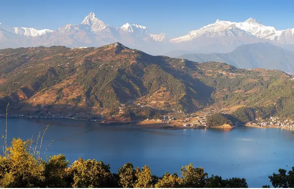
Pokhara, the capital of Gandaki Province and Nepal's second largest city with 600,051 inhabitants at the 2021 census, sits in a bowl-shaped valley that behaves like a textbook thermal illustration. At the bottom lies Phewa Lake, at 742 metres altitude, the third largest lake in Nepal and by far its most visited. Water heats slowly and steadily, so the lake acts as a calm, stable floor. Around it, the city and its terraced slopes heat quickly. And on the valley's northern rim stands the Sarangkot ridge, whose launch meadows sit at about 1,592 metres, more than 800 vertical metres above the water.
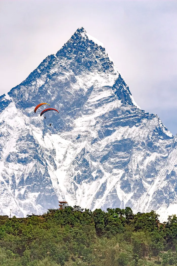
That combination, a cool lake, a hot basin and a sun-catching ridge, is why Pokhara flights are so consistent. Morning air slides up the Sarangkot slopes, thermals release along the ridgeline, and gliders drift out over the lake with the Annapurna range filling the northern sky. Most tandems follow a similar arc: launch from the ridge, work lift along the hillside, glide across the water and land on the Lakeside plain. When conditions strengthen in the afternoon, pilots extend the same arc into full thermal and cross-country routes. This reliability is why the Pokhara paragliding guide and the Sarangkot tandem flight guide both treat the valley as Nepal's benchmark, and why our Pokhara vs Sarangkot comparison focuses on timing within the same thermal day.
How Do Ridge Lift and Thermals Work Together at Sarangkot?
Thermals are only half of Nepal's lift story. The other half is ridge lift, created when wind strikes an obstacle such as a mountain ridge or cliff that is large and steep enough to deflect the air upward. Where a steady breeze pushes against a slope, a band of rising air forms along the ridge crest, sometimes extending hundreds of metres above and in front of it. A glider parked in that band can hover almost motionless, facing into the wind, with the ground racing below.
The best flying happens where the two systems meet. Sarangkot's ridge catches the daily anabatic breeze, so pilots get smooth ridge lift as a baseline, while thermals release from the sunniest spurs and add powerful bursts of altitude. A skilled pilot uses the ridge to stay up between thermals, and uses thermals to climb high enough to venture over the valley. Passengers feel this as variety: a few minutes of steady gliding along the hillside, then a slow spiral upward as the wing bites into a thermal, and finally a long, silent glide out over the lake. For more on how the launch site itself shapes each flight, see our companion piece on paragliding near Pokhara, beyond Sarangkot.
What Makes the Kathmandu Valley a Different Kind of Flying Classroom?

The Kathmandu Valley, the bowl-shaped valley that holds Nepal's capital, flies differently from Pokhara. It sits within Bagmati Province, Nepal's most populous, a mostly hilly province that stretches from the Terai to the Tibet border. The valley floor holds at least 130 important monuments and seven World Heritage Sites, a dense, heat-absorbing urban fabric that warms quickly, while the surrounding ridges, including Chandragiri to the southwest, supply the launch ramps. Flights here tend to be shorter and calmer than Pokhara's: pilots work the morning window before the high valley air becomes too energetic, using ridge lift more than big thermals.
For visitors, that difference is an opportunity rather than a limitation. Kathmandu flying slots neatly into a sightseeing day: you can be airborne above the heritage valley in the morning and standing in a medieval palace square by lunchtime. Our guide to paragliding in Kathmandu covers the main sites and what to expect, and the Chandragiri launch guide profiles the valley's closest ridge. The Kathmandu destination guide rounds out the ground-side itinerary.
Why Is the Kali Gandaki Gorge a Legendary Wind Corridor?
Between Dhaulagiri and Annapurna I, which lies just 34 kilometres east, flows the Kali Gandaki River through the world's deepest gorge. The scale is difficult to picture: two eight-thousand-metre walls with a desert valley floor between them. The town of Jomsom, the administrative headquarters of Mustang District, sits in that corridor at about 2,700 metres, straddling the river, with the soaring peaks of Dhaulagiri and Nilgiri as a backdrop. Along its banks, black fossilised stones called shaligram, revered as symbols of the god Vishnu, can still be found.
Geographically, a gorge that deep acts as a wind gun. Each day, the sun heats the valley floor and air rushes up the corridor toward Tibet; each night the flow reverses, cold and dense, back down toward the plains. For paraglider pilots this is some of the most powerful, predictable valley wind on the planet, and it is flown mainly by experienced pilots who respect its strength. Tandem tourism here is far less developed than in Pokhara, and that is precisely the point: Mustang's flying is about raw geography, not convenience. Travellers curious about the region can start with our Upper Mustang destination guide, and the neighbouring Kushma flying guide covers the gorge's southern rim, where tandem flights run above the same river system.
How Do the Mahabharat Ridges Shape Sites Like Bandipur?

Not every great Nepali launch sits in a famous valley. The Mahabharat Range, the middle band of the Nepal hill country, runs the length of the country and holds some of its most charming small sites. Bandipur, a ridge-perched town about halfway between Kathmandu and Pokhara, is the best example. Its launch meadows sit in open hill country above the town, where the anabatic flow arrives softened and steadied by long, forested slopes. Flights here feel spacious and unhurried, with the ridge lift gentle enough for nervous first-timers and thermals generous enough to satisfy experienced passengers.
Middle-hill geography also means variety. In a single hour of flying at Bandipur you can work a ridge, cross a saddle, drift over terraced farmland and climb a thermal off a sunlit spur, all without ever leaving sight of the town. Our Bandipur paragliding guide explains how to reach the site and what a flight there costs. South of the Mahabharat, the Churia (Sivalik) hills of the outer Himalaya, famous for their fossils, complete the staircase; they are walked and farmed more than flown, but they remind you how many distinct land bands Nepal compresses into a short drive.
Which Nepal Region Offers Which Flying Conditions?
Because Nepal's paragliding geography varies so much from band to band, it helps to compare the regions side by side. The table below summarises what the terrain does to the air, and what that means for you as a passenger. Prices and access differ just as much as the flying itself, so pair this with our cost overview further down.
| Region | Landscape | Air character | Best for |
|---|---|---|---|
| Pokhara Valley (Gandaki) | Lake basin at 742 m, Sarangkot ridge at about 1,592 m | Reliable thermals and ridge lift, smoothest in the morning | All levels, from first tandems to long thermal flights |
| Kathmandu Valley (Bagmati) | Bowl-shaped capital valley with surrounding ridges | Calmer morning windows, ridge lift more than big thermals | Visitors pairing a flight with heritage sightseeing |
| Bandipur (Mahabharat ridge) | Open meadow launches above a ridge town | Gentle ridge lift plus soft thermals off long slopes | Nervous first-timers, travellers mid-route to Pokhara |
| Kushma (Kali Gandaki rim, Parbat) | Gorge-edge launches above the Kali Gandaki | Funnelled valley winds, energetic and steady | Adventure travellers combining flight with the gorge bungee |
| Mustang / Jomsom (trans-Himalaya) | High desert corridor at about 2,700 m between 8,000 m walls | Powerful, clockwork daily wind cycle | Experienced pilots; limited tandem infrastructure |
| Far West (Sudurpashchim) | Remote mid-hills and alpine plateaus such as Khaptad | Largely unexplored; expedition-style arrangements only | Private groups with licensed pilots, see our Far West guide |
When Is Paragliding Season in Nepal, and Why?
Nepal's flying calendar follows the monsoon. From roughly October to March, after the summer rains clear and before they build again, the air over the hills is dry, visibility is superb and thermals switch on with almost boring regularity. October and November are the classic months: freshly washed skies, green valleys, and mountain views that stretch from Annapurna to Dhaulagiri. Winter, from December to February, keeps the skies clear but softens the sun, so thermals arrive later in the morning and climb to more modest heights, which many beginners find comfortable.
Spring, from March to May, is the connoisseur's window. Stronger sun means stronger thermals, longer cross-country potential and dramatic cloudscapes, though pilots watch the sky more carefully as the season builds toward the monsoon. From June to September the monsoon dominates: humid air, daily cloudbursts and reduced visibility ground most commercial tandem operations. The geography that makes Nepal so soarable in the dry season, deep valleys and fierce sun, is exactly what makes it unflyable in the wet one. Whenever you come, booking through our paragliding in Nepal activity page gets you pilots who judge the local conditions daily.
How Do Monsoon and Winter Change Nepal's Flying Weather?

The two hardest seasons for flying are also the most instructive about Nepal's geography. In late spring, as the monsoon approaches, warm humid air feeds tall, fast-growing cumulus. A small puffy cloud can build into cumulus congestus, the taller, more vertical form, within an hour, and under such clouds lift can turn violent. Responsible pilots fly the smooth morning windows, keep an escape route to the landing field and land well before the sky turns gray. That discipline is why commercial tandem flying in Nepal has such a strong safety culture.
Winter flips the problem. Cold, dense air drains off the high country each night, and the valleys start the day under a stable lid, sometimes with morning fog over lakes like Phewa. Thermals fire late and top out low, but the air between launch and landing is glassy and calm. Winter flights reward passengers who want smoothness over adrenaline: long silent glides, crisp light on the snow peaks, and landings in the warm afternoon sun. Machhapuchhre, the sacred fishtail peak that has never been officially climbed, looks its best in this season from a wing above the Pokhara Valley.
What Do Cumulus Clouds Tell You About Thermals?
Cumulus clouds, the puffy, cotton-like clouds with flat bases, are the visible scoreboard of thermal activity. Their name comes from the Latin cumulus, meaning "heap" or "pile", and each heap is the crown of a thermal: moist air rises, cools, and condenses at the altitude where its moisture can no longer stay invisible. That flat base is not decoration. It marks the condensation level, which in practice is the ceiling of the day's usable lift, and the cloud grows upward exactly as long as the thermal beneath it keeps feeding.
Pilots in Nepal read these signals constantly. A line of small, evenly spaced cumulus over a ridge is a thermal street, a sky highway of lift you can follow for kilometres. A dissolving cloud signals a thermal that has already shut down, and the clear gap beneath it is usually an area of sinking air to cross quickly. Towering congestus means the day has become too strong for casual flying. For passengers, the practical translation is simple: scattered friendly cumulus over the valley in the morning means your flight will probably include at least one memorable climb. For the full picture of what a flight includes hour by hour, start with the complete guide to tandem flights in Nepal.
How Does Geography Shape Tandem Flight Prices in Nepal?

Nepal's tandem prices follow its geography more than you might expect. Where the terrain is easy to reach and many operators share one reliable launch, competition and volume push prices down. Where access takes hours of driving or the site is young, prices rise or the model shifts to private arrangement. The figures below reflect the current market across the main sites, consistent with what we publish in our site-by-site guides.
| Flight option | Typical price | What the terrain gives you |
|---|---|---|
| Standard Pokhara tandem (20 to 30 minutes) | NPR 8,500 to 12,000 | Sarangkot launch, lake crossing, Lakeside landing |
| Cross-country / thermal tandem (45 to 60 minutes) | NPR 12,000 to 15,000 (about USD 65 to 95) | Extended thermal climbs above the valley |
| Kathmandu Valley sites (Chandragiri, Godavari and others) | USD 70 to 140 | Ridge flying over the capital bowl |
| Kushma tandem | NPR 6,000 to 10,000 (about USD 45 to 75) | Gorge winds above the Kali Gandaki |
| Photo and video package (any site) | USD 15 to 25 | Onboard camera record of your thermal climbs |
Nationally, a tandem flight in Nepal costs between roughly NPR 5,000 and 12,000 depending on the site and the duration, which keeps the sport among the most affordable serious adventures in the country. The thermal lesson in those numbers is worth noticing: the best geography in Nepal, Pokhara's lake-and-ridge bowl, is also the cheapest place to fly it, because reliable conditions let operators run full daily schedules. You can compare current options and book on the paragliding in Nepal activity page or browse every trip on our tour list.
Which Treks and Tours Pair Well With a Paragliding Day?
Nepal paragliding geography rewards travellers who combine air time with ground time, because the same valleys that produce thermals produce world-class walking. From Pokhara, the classic pairing is the Ghorepani Poon Hill trek: you walk to the famous viewpoint near Ghorepani at about 2,874 metres inside the Annapurna Conservation Area (a park permit is required), watch dawn break over Dhaulagiri and Annapurna South at 7,219 metres, then descend to fly over the lake basin you viewed on foot. Shorter ridge walks such as the Mardi Himal trek or the quiet Panchase panorama trek fit the same rhythm in fewer days.
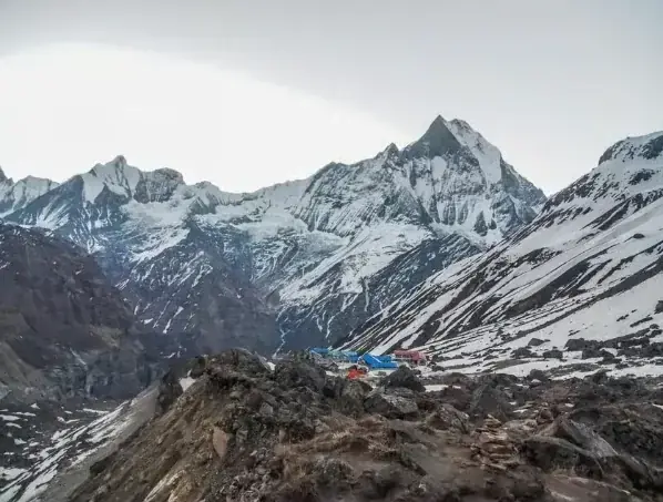
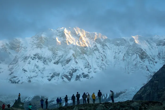
For a fuller immersion in the same mountains you flew beside, the Annapurna Base Camp trek reaches the sanctuary at the foot of the 8,091 metre peak, while the Khopra ridge trek offers a wilder balcony over the Kali Gandaki country. Travellers who prefer their geography with culture mixed in can start from the capital with the Kathmandu and Pokhara scenic and cultural tour, which positions you perfectly for a Pokhara flight day. However you build the itinerary, the Pokhara destination guide covers the ground logistics.
Is Flying in Nepal's Mountains Safe for First-Time Tandem Passengers?
Yes, and the geography deserves much of the credit. Nepal's commercial tandem sites were chosen precisely because their terrain produces predictable, well-behaved air. Pokhara's lake basin acts as a huge, forgiving landing area. Bandipur's soft Mahabharat slopes smooth out the bumps before they reach the wing. Sarangkot's launch faces onto open valley air rather than confined mountain terrain, so pilots can always glide out to safety rather than being trapped against a wall. Operators schedule flights in the gentle morning and midday windows and cancel when the thermal day turns aggressive.
Your part in the safety chain is simple. Fly with licensed, insured operators, answer the pre-flight briefing honestly about your health and weight, run the few steps at launch as instructed, and let your pilot make every in-flight decision. Helmets and certified tandem harnesses come standard with reputable companies. If you are nervous, say so when booking: pilots can plan a shorter, smoother morning slot in the calmest air. Our safety and costs guide lists the questions worth asking any operator, in Nepal or anywhere else.
What Should You Pack for Nepal's Flying Conditions?
Nepal's geography means you can be sweating in a valley town and shivering at cloudbase twenty minutes later, so dress in layers. A light fleece or windproof jacket over a t-shirt is the standard uniform for a tandem flight, closed walking shoes or trainers rather than sandals, and long trousers to keep the harness comfortable. The sun is fierce at flying altitudes even in winter, so bring sunglasses, sunscreen and a cap that will not blow away, and a small bottle of water for the launch meadow where you will wait while pilots read the sky.
Leave the rest light. Operators supply helmets, harnesses and everything wing-related, and lockers in the Lakeside offices hold bags while you fly. A phone or compact camera fits in a zipped chest pocket, though most pilots also offer the photo and video packages mentioned above, which capture the thermal climbs better than a passenger ever can. If your flight is part of a longer itinerary that includes trekking in the Annapurna Conservation Area, pack for both: the same layers that keep you warm at cloudbase serve you at a 2,800 metre viewpoint the next morning. Browse the full range of trips that combine flying, walking and culture on the Enticing Himalayas tour list.
The Verdict: Geography You Can Feel

Most destinations sell you scenery. Nepal sells you the physics behind it. The stacked tiers of Terai, Churia, Mahabharat and Great Himalaya, the 850 metre jump from Phewa Lake to the Sarangkot launch meadows, the wind gun of the Kali Gandaki gorge: these are not trivia, they are the working parts of the most reliable free-flight machine in the Himalaya. When a tandem wing lifts off a Nepali ridge and starts to climb with no engine and no sound but the wind, you are feeling geography do exactly what it has done every clear day for millennia.
That is why thermals matter. They are the difference between a ten-minute scenic glide and an hour-long journey across a lake basin below the Annapurnas, the difference between watching mountains and joining the hawks above them. Come in the clear season, pack a fleece, trust your pilot's weather call, and let Nepal paragliding geography do the rest. Explore, Heal, Thrive.
Frequently Asked Questions About Nepal Paragliding Geography
What makes Nepal's paragliding geography special?
Nepal stacks immense vertical relief into a compact area: the Terai plains, the Churia hills, the Mahabharat ridges at 3,700 to 4,500 metres, and the Great Himalaya with more than 100 peaks above 7,200 metres. Deep warm valleys sit beside cold high ridges, so the temperature contrasts that create thermals are strong, daily and dependable across the whole country.
What is a thermal in paragliding?
A thermal is a rising column of warm, buoyant air created when the sun heats the ground unevenly. Sunlit slopes, rocks and fields warm the air above them, and that lighter air lifts off in an invisible column. Pilots circle inside thermals to gain altitude, then glide between them, which keeps a wing with no engine airborne.
Why is Pokhara considered the best place to fly in Nepal?
Pokhara combines a warm lake basin at 742 metres with the Sarangkot launch ridge at about 1,592 metres, over 800 metres apart. The lake heats steadily while the slopes heat fast, so smooth morning air and reliable afternoon thermals form daily in season, and flights end over open, forgiving landing ground near Lakeside. Few valleys anywhere offer this consistency.
When is the best season for paragliding in Nepal?
October to March is the prime window, with the clearest, most stable post-monsoon air in October and November, gentle winter conditions from December to February, and stronger spring thermals building from March to May. The June to September monsoon brings daily rain, humidity and poor visibility, so commercial tandem operations pause. Booking in the dry months maximises flying chances.
Are thermals dangerous for first-time tandem flyers?
No, thermals are what make tandem flights long and memorable rather than short. Pilots choose gentle morning windows for beginners, work soft lift along ridges, and land before strong afternoon conditions build. Reputable operators fly only in suitable weather, supply helmets and certified tandem harnesses, and brief you on the simple steps, so the experience feels exciting but controlled.
How much does a thermal or cross-country tandem flight cost in Nepal?
In Pokhara, a standard 20 to 30 minute tandem costs NPR 8,500 to 12,000, while a 45 to 60 minute cross-country or thermal flight costs NPR 12,000 to 15,000, roughly USD 65 to 95. Kathmandu Valley sites run USD 70 to 140, Kushma flights NPR 6,000 to 10,000, and photo or video packages add USD 15 to 25.